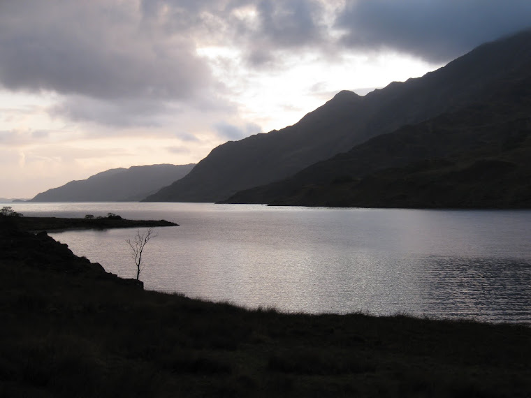
View from Oban Bothy

View from Oban Bothy

Friday 15 September 2017

Trotting around North Cheshire, Sat 29th April 2017

Point-to-Point 2017

I was all a bit last minute, but I volunteered to help plotting a little running route, the Hartley Folly, the Cheshire Hare & Hounds Tally-Ho! end of season run – always a bit longer than the Club’s regular fortnightly runs.
Tim, the original plotter had been inundated with so much work (the sort of work that people go out to) and family stuff that he was rendered unable to get stuck in and sort the job.
I had the following parameters to work within:
Start point: The Griffin in Bowdon (a rather posh part of already posh Altrincham)
Finish point: The Swan with Two Nicks, Little Bollington (a lovely pub in a lovely hamlet)….around 1.5 miles from the start
The route should be a long(ish) one – and definitely be predominantly cross-country.
There must be a tea stop.
If you’ve been keeping up and not fallen asleep (yet) you’ll have noticed that the 1.5 miles between the start and inish doesn’t constitute ‘long’. Or even ‘long-ish’.
Tim had come up with good start and finish points, so that was something I didn’t need to worry about – it was just the bit in between.
After much studying of maps and loads of recces I settled on a pleasant 19 mile route that took in some interesting bits of local countryside.
The recces, and there really were many, were carried out with the invaluable assistance of Mssrs Coatsworth, Banfield and Normanand Mrs Fairley who provided much in the way of (constructive?) criticisim. Atcherly, having those extra pairs of eyes proved invaluable in tweeking the route and it’s description – thanks guys….and gurl.
Anyroadup, the route wasn’t particularly original, more a tweek of a route I’d walked / run in the past.

19 miles of clockwisery:

Tally-Ho Hartley Folly 2017 full map Rev4
On the day itself I set out alone but armed with a bag of sawdust to mark bits of the trail where runners could have lost the intended route. I was probably the first to start – I wanted the extra time to drop sawdust where I thought it might be needed. And I’m a bit on the slow side. Rather a lot on the slow side actually.
The route left Bowdon and so did I, initially on quiet suburban roads and paths before heading down to follow the River Bollin upstream. The river passes the back gardens of some enormously expensive and expansive houses on one side and the uber-posh Hale Golf club on t’other. Apparently the odd famous footballer / manager can often be seen walking their doggies on the river bank. I wouldn’t know an odd famous footballer or a manager if they bit me.
P1070448
I dropped a few clumps of sawdust along the way, nothing conspicuous, but enough that runners following me would spot the stuff.
The weather was ideal for trotting along, dry and bright but not too warm – a hot day wouldn’t do at all for a 19 miler, however slow I was.
P1070427
It was still early in the year so whilst undergrowth was quite verdant, the trees were lagging behind – few were in full leaf.
P1070428

P1070429
The River Bollin close to Sunbank Wood
My original route was to take me through Castle Mill but the previously good footpath had been illegally diverted through a mud-bath that really was quite impassable. The obnoxious land owner has been reported to the local authority who are taking action against her.
P1040149
Castle Mill’s mud-bath …and electric fence. Photo taken on a recce.
My alternative route bypassed the quagmire and entailed passing our local trig-point, looking a bit forlorn. I have a plan to brighten it up….

P1070430
The rather sad trig point at SJ796837 marking the dizzying altitude of 60m ASL
The sound of aircraft now became noticeable, I was approaching the end of one of Manchester Airport’s runways.
The River Bollin proved a bit of a problem to the contractors charged with extending the airport with the addition of Runway 2. The problem was solved by culverting the river under the new runway:
P1070449

Doggy walkers were walking their doggies and birdies were tweeting in the hedgerows, it was only the occasional roar of aircraft taking off that spoiled an otherwise very pleasant trot alongside Runway 2
P1070453

There was just a bit of tarmac beyond the airport (sorry guys, even the best trails often have SOME tarmac!) but the trail was soon back on field paths that skirted the north side of Mobberley. It was on this section that the first runners caught me up (and passed me…of course), I was beginning to wonder if anybody had turned out to follow trail.
P1070459
Here they come…
P1070460
….and there they go
Numbers weren’t great on the day. Excuses for absence were many and vairied, Hon Sec had the best one – he’d broken his arm whilst on the Lakes Weekend trail run.
P1070456
Approaching the tea stop
Whatever, it was good to catch up with Tim & Rob at the tea stop:
P1070461
Tim’s wife and family had provided a very splendid spread for us, it was easy to eat and drink too much – Not A Good Thing To Do when there’s still another 9 – 10 miles to run.
As we guzzled and slurped our way through the feast more runners appeared:
P1070462
P1070464
Fast Taylor – going remarkably fast considering he was nursing an injury
P1070463
Hon Prez Park….say no more
Dragging ourselves away from the tea stop we plodded off along more tarmac to enter Tatton Park at it’s southern, pedestrian only, entrance. The trail now changed direction, turn north on the eastern shore of Tatton Mere. The run through the park was very easy running, we were treated to a toilet stop and a herd of curious onlookers.although they weren’t watching us at the toilet stop.Probably.
P1070465 
The next point of note was the No 1 Parachute Training School monument in the park. Ringway Airport (now Manchester Airport) was the site of the training school and parts of Tatton Park were used as a landing zone. Tatton Mere was used to practice water-landings.
P1070433
P1070468 
Poseurs at the monument, L>R: Mssrs Taylor, Park, Bell, Jenkinson, Riley & me
Turning west(ish) towards Tatton Hall, Hon Prez Park was delighted to see that we’d arranged for his own personalised route out of the park:
P1070469
More northness followed, this time to Rostherne, along a church path – reputed to be the path used by the Tatton Estate workers to get to St Mary’s Church at Rostherne.
P1070435
Taken on one of the recces: Martin at Rostherne Village Water Pump

P1070439

P1070440
P1070470
The church grave yard had some interesting, er, features 
A concessionary footpath, not marked on the OS map, takes you nicely past the church and allows views over Rostherne Mere:
P1070441
Rostherne Mere
In the two weeks leading up to the run one of the field footpaths had seen a significant diversion to allow for ploughing. This lengthened the route – but just two days before the run the diverted path had been re-instated and all was well.
P1070443

More tarmac followed, although it was less than a mile and along very quiet lanes before once again getting onto the (slightly) rough stuff. The ground was generally quite dry although the odd bit of wetness muddied the legs – giving just a bit of credibility to our cross-country run.
Once over the M56 on the footbridge to the east of the Lymm roundabout we were on the home leg. We once again met up with the River Bollin, now on the outskirts of Bowdon….home to the Club’s esteemed legal advisor.
P1070471
River Bollin bailiff’s shed near Bowdon
We ran west along the north side of the river, passing the site of the Motte & Bailey castle at Watch Hill. It’s well worth watching this YouTube video.
P1070472
Taking our lives in our hands we crossed the very busy A56 and continued to follow the River Bollin along another concessionary path to the Swan with Two Nicks and the end of the run.
I took about 5 1/2 hours to complete, I was quite happy with that considering I’d spent around half an hour at the tea stop and spent additional time laying trail.
The pub was unable to provide bathing facilities – or even a room to change in. The Club’s tin bath was once again pressed into service in the pub car park. Pretty Quick Riley opted to cool his legs off with the pub’s hose pipe before diving into the bath. At least that what he said he was doing:
P1070473

Tim & Co had arranged for a gazebo to preserve the dignity of the runners and to spare the blushes of the pub’s customers.
P1070474
Our luxurious bathing facilities
An excellent nosh followed. Runners, helpers, guests and partners enjoyed a fine meal supplemented by beers from the Dunham Brewery. And I wasn’t driving.
Thanks to all who helped with recces and planning the route, in particular Tim, Andy, Martin and Joules. Your inputs really were invaluable.
Thanks also to Tim’s family who fed and watered us so very well, to everyone who ran the route – and to The Club for letting me plan the route.
Smile

Saturday 26 August 2017

Camping in Keld with Knackered Knee Knipe….

….and Dawn. And LTD too. Just to add some sobriety and sensibility to the trip.

That Dawn had organised a static camping visit to Keld, famous for not having a Youth Hostel anymore so that Pennine Way and Coast to Coast walkers would have to struggle to find budget accommodation in the area. Clever or what?

P1030803

P1030825

The last time I was in Keld was when No2 son and I did the Coast-to-Coast. He was 8 and I was just a bit older than him. We stayed at the Youth Hostel and very pleasant it was too. The loss of yet another hostel in a remote-ish area is grievous to say the least.

Anyroadup, Mike & Dawn had arrived at Rukin’s Campsite before me and had gone for a wander and a swim. This left me to set about fighting (single-handed) Keld’s famous ferocious midges whilst putting up my tent. My chosen tent for this little adventure was my Sil Hex Peak V4 – a nice and spacious shelter.

P1030795

What the well-equipped Ultra-Light Backpacker carries this season

By the time KKK and Dawn had returned, the midge attack had subsided. But this wasn’t a retreat, the cunning buggers had merely regrouped and called in reinforcements to launch an even more determined attack.. Little sods. Anyway, all was not lost: they hadn’t reckoned with Dawn’s very effective joss-sticks, a good dollop of Deet, and a very smoky fire. And then we had a beer to calm our nerves.

P1030794

Our Midge Repellent Machine (Pat Pending) & the KKK shelter

P1030793

A dog and his dad

Mike had arranged a slightly huge stew-type thing for tea, it was a bit good but there was rather a lot of it. This was where Lucky stepped in to help out, there was no way that we 3 mere mortals could eat all that lovely grub.

Then it started to rain.

So me and KKK had another beer, a good chat to put the world to rights and a not particularly early night. During the night it rained noisily and heavily.

The following morning, and after all that energetic nocturnal snoring, we surfaced with an enormous appetite for bacon butties – fortunately I’d packed the necessary.

The rain had stopped, the sun was sort of shining and most of the midges seemed to have vanished – drowned probably.

A great packing up of the tents followed which in turn was followed by a wander Swaledale to a rather pretty waterfall where neither KKK, LTD or Dawn would swim.

P1030806

River Swale waterfall: Wain Wath Force….probably.

Two children were having a ball in the water, the young lad was having a great time leaping into the water:

P1030809

P1030810

P1030811

I’m still learning how to use my Lumix TZ70 and hadn’t got to grips with the ‘Burst Mode’ setting – hence I only managed to take these 3 sequential shots. A shame, the camera is capable of taking more….I now know for next time.

P1030812

Free Range Egg’s

A couple for Alan R:

P1030821

P1030820


A decision was taken by someone to go and annoy the delightful Amanda Owen, famous for being a shepherdess and having lots of children. Her family live just 3-4 miles from the Tan Hill Inn – where we didn’t go.

P1030823

Ravenseat

A sometimes quite muddy path led us to Ravenseat, the Owen family’s farm.

P1030819

Amanda & family live what appears to be an idillic life, miles away from anywhere (if you exclude the Tan Hill Inn) and a wonderful playground for the children. In reality I suspect

that life in that remote spot must be quite hard at times. For all that, they make excellent scones (with cream and raspberry jam they’re REALLY yummy) and brew a fine pot of tea.

P1030826


P1030829

Swaledale Field Barn

P1030827


P1030831


P1030832

River Swale (Currack Force?)

The return route to Keld avoided the muddy horribleness of the outward leg and we were soon back in Keld and back at the car park….and then it was time to go home. I couldn’t be mithered cooking so a visit to the Timperley Fish Bar, my favourite fish & chip shop, was called for. I ate too much. Again.

Thanks to Lucky, KKK and Dawn for inviting me along – it was good, in spite of the midges…..and my own knackered knees.

Smile

Wednesday 2 August 2017

Lleyn Peninsula Backpack, 28th July 2017

Just a few photographs taken last week / weekend whilst backpacking a section of the Wales Coastal Path.

This was a fairly last-minute expedition that worked out nicely – apart from the torrential rain and high winds on the first night. I rather unwisely decided to leave the Akto behind and used the smaller and more crapmed LaserComp – a fine little tent, but I really could have done with a bit more room considering the horrid conditions of the first night.

The Plan consisted of spending the first night at Llandystumdwy (Lloyd George knew my father and all that…), having a bit of an explore in the car the next morning, then leaving the car at Lloyd George’s place I wandered west from near Llanbedrog through Pwllheli (famous for Butlins, the Royal Navy and a fine Wetherspoons pub), Abersoch, Aberdaron and round the end of the peninsula before hopping on a bus back to the car.

It’s an excellent coastline although the Wales Coastal Path wasn’t that easy to follow. The path doesn’t religiously stick to the coast and some of the signposts were ‘misleading’ which made following the route rather difficult at times. also some of the paths and bridleways marked on the current maps didn’t exist on the ground. Nowt new there then. Consequently I didn’t cover the distance I’d planned. no matter, it was very enjoyable.

Water was a problem, the coastal farmland was heavily populated with livestock so rivers and streams were a no-no. A public loo (with a shower!) in Aberdaron plus a couple of pubs and a garden hose came to my rescue. Churchyards, unusually, didn’t have water taps….perhaps because of the higher rainfall levels on this coast.

The coastline is very dramatic and the area warrants another visit….in September actually. The route is yet to be decided but I’d be very happy to re-visit much of what I covered on this trip. Discussions on this matter with the Lucky, Luck’s Dad, Dawn and me are to take place soon.


P1030567


P1030568


P1030569


P1030572

Hell’s Mouth

P1030575


20170731_073150

Boots….but no dead mouse this time

20170729_130802


20170730_134333


20170730_163514


P1030581

Aberdaron

P1030582

An Ultra Marathon had taken place the previous day, a 63 mile trot along the coast

P1030583


20170731_091239


20170731_083928


20170731_100902

Barnsley Bardsey Island

20170731_073450


P1030592


P1030593


P1030597


P1030599


P1030601


P1030602


P1030603


P1030605


P1030607


20170731_104043

Another brew with a view

P1030612


P1030616


Some of these photos are out of order….on account of M$ Windows funny ideas of file management. I gave up trying to re-order them, that will have to wait for another day.

Photographs were taken with my Lumix TZ70 and my Samsung S5 phone.

Tally-Ho! Whitworth Wander / Turkey Trot 2023

  Whitworth Wander – Turkey Trot, 27 th of a very wet December 2023 In memory of the late Brian Whitworth, a fine man, my friend, and a for...