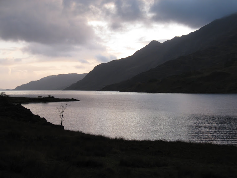
View from Oban Bothy

View from Oban Bothy

Thursday 27 December 2018

Tally-Ho! Turkey Trot, 27th December 2018

The Club’s Hon Sec has been a bit under the weather of late so it was deemed that this year’s Turkey Trot be run close to his home so he could come out to see us, drink beer and join us for the post-run nosh.

The chosen venue was the Olde Number Three pub in Little Bollington, a pub that has had mixed fortunes of late but now seems to be well and truly back on it’s feet, serving good beer and good food at very sensible prices.

image

As a local lad, and having some knowledge of the countryside around the pub, I volunteered to plot, plan and lay trail. This entailed a 9am start….not the best plan for the day after Boxing Day….but there you go.

The route headed south following footpaths that crossed the odd stream and muddy patch. So far so good.

At the M56 the sawdust trail was laid East to pick up farm tracks, the tarmac of Reddy Lane and yet more tracks and tarmac…it’s a good job that the TT isn’t a candidate for Trail of the Season!

The trail led across fields and some seriously gloopy man-eating fetid swamps to the the familiar sight (for those who did the P2P a couple of years ago) of the Swan with Two Nicks.

P1060637

The pub was closed (Boo!) and the paths leading north into Dunham Park were quiet. The River Bollin weir was roaring well, testament to the recent rainfall:

P1060638

A couple of National Trust warden types were curious as to what I was up to, I explained and they seemed happy enough….actually they were mildly amused by the whole thing. It’s good to leave folk smiling!

Continuing NE through the now busy deer park (busy with visitors and deer) the trail eventually crossed Charcoal Road by the gated lodge entrance to enter the Dunham Golf Club which is conveniently criss-crossed by a number of footpaths. Laying trail here was a little difficult, I was trying to be inconspicuous….I don’t think my efforts were successful.

P1060639

We went the other way….


Emerging in Dunham Town the sawdust led northwards to pick up the Duke’s Cut and then into Dunham Woodhouses. Just short of The Vine (Sam Smith’s, £2 / pint) the trail went south….well it turned left anyway. The ground was a bit soggy and damp here, the route crossed a couple of streams (Agden Brook being one of them) and the River Bollin – by way of a footbridge.

At Agden Bridge Farm the route again joined the Bridgewater Canal towpath, this time heading east.

It may have been a little disconcerting to the hounds to be passing the Olde Number Three on the opposite bank of the canal and with no apparent means of crossing to it…..not without getting feet and other bits wet.

A solution to this little problem soon presented itself close to Little Bollington, a tunnel under the canal.

Splodging (uphill….please note!) through a field of horses the hounds were soon racing (?) westwards along the opposite side of the canal and the final run in to the pub.

Big Ian, camera in hand, was waiting at the pub……he’d not been out on the run but wanted to join us for lunch.

image

Only one hare today

Runners began appearing – Hon Prez Park being first man in, no doubt driven by thirst and hunger:

P1060643

Other runners appeared, running on t’other side of the canal but visible from the pub car park. Cameras were readied to record their auspicious arrival:

image

image

P1060641

P1060640

It should learn to calm down…


image

20181227_121744


image

20181227_115713

The Trail-Layer doing his post-run stretch

20181227_134558

Whalley had collected and transported the Hon Sec to the pub where we all enjoyed a beer (maybe more), a nice meal and, far more importantly, good chat with Brian – who seemed to be on good form.

It was a good run. I measured it at 8.8 miles with around 300 – 330ft of ascent, so not the hilliest of trails. Having said that, looking through the Club’s history it would appear that the route covered traditional Tally-Ho! terrain and so it was considered to be acceptable.

Turkey Trot 2018

Thanks to everyone who turned out to make it a successful day for the Club, and especially for Brian.


Photos by JJ and Big Ian
Saturday 1 December 2018

Wildboarclough Wander, Saturday 1st December

Out and Round Cut-thorn Hill

TallyHologo_thumb1

The persistent rain drifted away to the east before the club arrived at the Crag in Wildboarclough but the clouds still loomed low over the hills. Brown and Riley had set a trail that led straight up the hill across the road from the pub although just below the tree line we veered left instead of the usual right and headed past Firs Farm and onto the road by Crag Hall. A right turn and a brief run up the road ensued.

It wasn’t long before we left the road to disappear on our right as we took to the countryside again. It was still uphill until the main road. We shot across the road and descended quite steeply to the side of Cut-thorn Hill. We followed the road down to Knar, where we took a left turn to drop down to cross the River Dane before setting off uphill yet again.

The advertising email that was sent round prior to the event promised a runnable course. It probably would have been if we had been 20 years younger. The first 3 miles or so was predominantly uphill so maybe the second half would be down. The clouds had gathered and we ascended into them, limiting the views to the back of the runner ahead.

P1060576

We turned sharp left to run below Turn Edge, slowly veering right to cross the edge and a slight downhill to Knotbury Farm then up to the high point of Wolf Edge.

P1060574

For AlanR


P1060579

P1060580

Running in the murk

A sharp left from the top and we ran down to the road at Oxenstitch. A left at the road and it was uphill again. We ran along the road for a bit taking the left fork at the junction and up to Readyleach Green before leaving on the right to run round Knotbury Common.

P1060582


P1060583


P1060585


P1060587


P1060588

Wells & Eastwood

As we dropped into the clough and met the stream we turned sharp left to follow the stream down to Panniers Pool at Three Shire Heads.

P1060590


P1060591


P1060593


Here we turned right and had to run uphill again, eventually finding our way to the A54. Straight across past Sparbent we finally had a downhill section and followed the clough down to the head of Cumberland Book. Here we turned onto familiar ground and “ran” down the very rough track to Crag House.

Crossing the road we had another uphill along past Banktop and down the steep road back to the pub.

P1060603

The Crag

The trail was very good, with much unfamiliar ground. The clouds cleared at the end to show Shutlingsloe outlined against the darkening sky, with only a little shower or two to suffer on the way round. McHarry managed to cut the trail short but did some extra when he arrived back. Pres Park took exception to a rock and headbutted it getting muddy as he did it. Park had a lump on his head. The rock was not seen again. DingDong Bell was out again after his accident last run, but only for a gentle walk along the flat with his finger encased in plaster.

The pub was now run by a new regime, with the old dining room now sealed for the production of bottled water. It was decorated for Christmas with two nice wood fires warming the room. The beer was good and the food very good. A steak and mushroom pie with chips and veg showed every sign of being homemade and very well done as well.

The Sticky Toffee pudding was very light and not too sweet. All were content and headed off in anticipation of the Championship.


Route

8.6 miles(ish) with around 1800’ of ascent…and descent.

Words by Wells, Pics by JJ

Wednesday 14 November 2018

Saturday 10 November 2018

4 Days, 100 miles, Part 3

Day 4: The Day of Cuijk, 42.8km, Friday 20th July 2018


Route Day4

Another uncomfortable night, not just due to the heat but also because of my poorly leg*

Another late start, 6am, meant a bit of a lie-in until 4.30am. It was getting quite light as I washed down a couple Ibruprofen with my first coffee of the day.

I hobbled off to the start, all the time wondering whether walking nearly 47km on hard tarmac was such a brilliant idea. The (nearly) 47km = 4km to the start and back + 42.8km for the actual day’s walk.

image

En-route to the start

Other than cyclists and pedestrians, there was little road traffic – it made for a beautifully peaceful walk to the start.

I managed to get close to the front of the start queue and I was on my way by 6.10pm. My leg had eased somewhat but I didn’t want to push it so I just ambled along for the first few miles, just to see how it coped.

P1050944

By 8am it was cookingly hot, this last day was forecast to be the hottest day of the event, 30+degC. I’d managed to pick up the pace to around 3mph, my leg was okay as long as I kept moving – it was really when I stopped and then had to restart that it hurt like hell…..so I vowed to keep my stops to a minimum. It worked.

image

Linden

image

Linden

image

Linden

image

Ladies in Linden


The walk from Cuijk over the pontoon bridge across the River Maas is particularly special. Every year the Dutch military make sure the 45,000 or so walkers keep their feet dry by constructing this impressive bridge – it’s one of the day’s highlights for me.

P1050955


image

P1050956

P1050958

Crossing the River Maas on the pontoon bridge

As well as international military involvement, there are other government department staff taking part in Vierdaagse: Police, Customs officers and more.

In past events I’ve spent time walking with UK bobbies, including Spike and his wife from Macclesfield, and so it was this year.

P1050959

A Dutch policeman invited Spike & Co on board his police boat where they were royally received and maybe treated to the odd beer and jenever. Not a very clear photograph I’m afraid – sorry Spike!

Approaching Nijmegen things start to busy up. Even more bands, more en-route entertainment and spectator support – an Ibruprofen top-up kept me moving through this party.

And then I came across….

image

…dressed in Dutch colours

We walked together for a few miles but they we moving faster than me (nowt new there then) and off they went, Via Gladiola-bound.

P1050962

P1050963

Approaching Via Gladiola in blistering heat

One of the popular sights on the Via Gladiola is that of a Dutch police officer trying to control the ‘traffic’. I took a video but it wasn’t good enough to paste here, so this is one nicked from YouTube.

image

Marching in


P1050968

The civilian finish line – the military had a few km further to go to their finish at Heumensoord.

So that was it, another Vierdaagse completed. I’m not sure if I’ll do another, they really are great fun but 100 miles on tarmac is hard on the body. I’m fairly certain that my leg pain was down to the hard surface.

Vierdaagse isn’t a cheap do: air fares, train fares, entry to the event itself etc. If you’re on your own, as I was, accommodation can be prohibitely expensive….made even worse by Brexit buggering up the £/Euro exchange rate.

The Numbers

Daily distances:

image


Start & Finish numbers:

Barometer


*Subsequently, after a visit to my GP, it was diagnosed as either a stress fracture or a shin splint. The good news was that it was just a shin splint – damned painful though.


Tally-Ho! Whitworth Wander / Turkey Trot 2023

  Whitworth Wander – Turkey Trot, 27 th of a very wet December 2023 In memory of the late Brian Whitworth, a fine man, my friend, and a for...