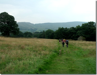
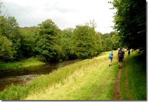
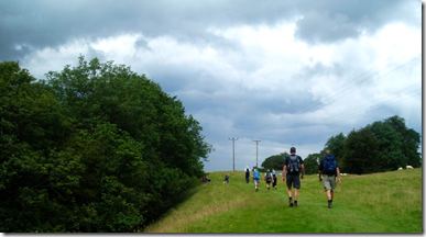
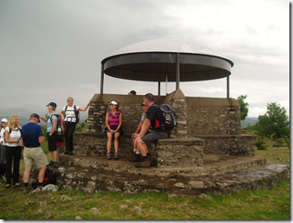
View from Oban Bothy

View from Oban Bothy

Sunday 19 August 2012

Two different ceilidhs

Friday 17th August

The Marmaladies have done this ceilidh before and reported back that it was fun. Held in the Friend’s Meeting House in Manchester city centre and run by the Quakers. The building is adjacent to Petersfield, site of the Peterloo massacre of 1819.
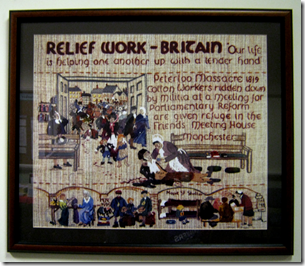
image The event promised to cheerful and gay. I’m not a religious type at all, but I’ve got a lot of time for the Quakers. The event was certainly gay.
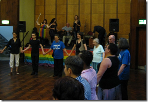
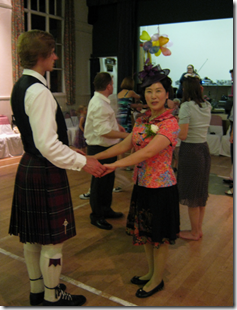
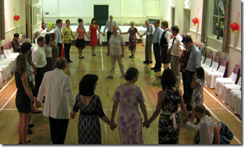
imageThe Marmaladies were operating with extras at this event. In addition to Clur on whistles and flute, and Marian on fiddle, we had Kathy on flute – she’s a long-time member of the band but has been in Glasgow for the last 4 years, John on guitar, Mike on Cajon (and a very excellent sound man), Brian as caller, and me on melodeon.  It was a lively musical mix, with and excellent caller and a tremendously enthusiastic, and sometimes colourful audience:
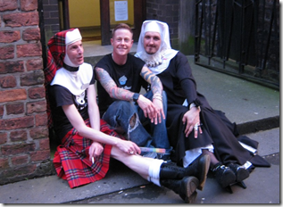
image An early finish (10pm) left us enough time to pile all the gear into Mike’s Tardis of a Landrover, squeeze the band in too, and then head to the Beech in Chorlton for rehydration.
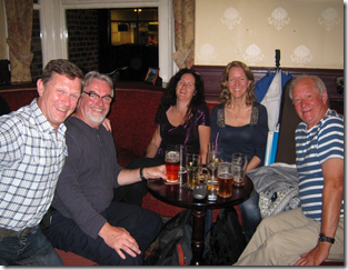
image L-R: A Beech Boozer, Mike, Clur, Marian, John. Centre: beer.
It was a brilliant evening, enjoyed by everyone. I really hope we get the chance to play this one next year.

Saturday 18th August

A different band for this one – Midgebites. We were one down for this one – Bill, our very excellent percussionist, has moved up to Morecambe to look after his poorly lady. The band insisted he stay with Gina, whilst she’s under the weather. Fingers crossed for her full recovery!
We were down to John W on guitar, Emma on fiddle, me on melodeon, and Brian as caller….. but no drum. This could be a problem.
We decided some time ago that if Bill couldn’t play with us for some reason, we would turn the booking down. What to do?
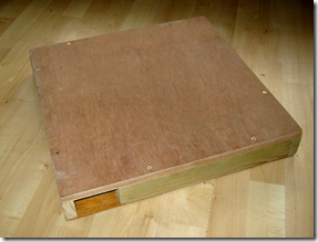
A couple of hours of messing about with bits of wood came up with a stompbox. It’s simply a box that has a microphone inside. I tend to stamp my feet in time with the music – so why not capitalise on my footwork. The box worked a treat. Okay, it didn’t have the fiddly, frilly drum sound that Bill produces so well, but we had a beat for the band to ‘lock’ on to – and it seemed to help the audience too.
image
The ceilidh was an Anglo-Chinese wedding…well he was British, she was Chinese. The reception was at a small church hall in Hale, not far from JJ Towers. As is often the case with weddings, it was a late start. We were booked from 8pm until 11.30pm, but the speeches etc delayed kick-off until 9.30pm. It was curious to see one half of our audience dressed in sober, western attire, whilst t’other half were dressed very brightly indeed.
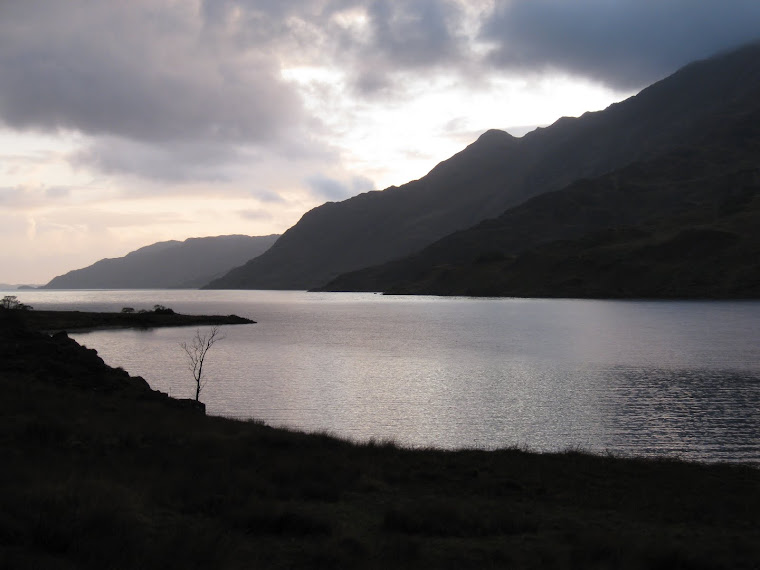
image Not all western attire is sober!
image
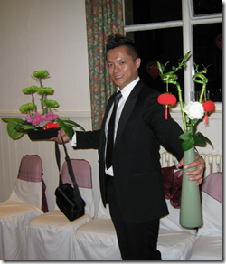
The Bride’s brother…I think
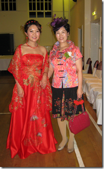
imageThe bride and a very proud mother 
image
Brian, our caller, doing his very best to explain a dance in English to our audience, many of whom only understood Chinese. It worked!
The evening went well. It was extremely hot and our little band were rather pooped by the time we left for home.
No more ceilidhs for a week or two now, there are backpacking trips on the horizon.

Thursday 16 August 2012

Tuesday, 14th August, A hot day from Walton

An email from Rick asking if I fancied a walk on Tuesday was met with the usual reponse…..’Yes’!

At 9.30am I piled into Rick’s car and we disappeared off to the very photogenic village of Higher Walton, SW of Warrington. The sun was blazing down and I was thankful to be carrying a litre of water in my Platy.

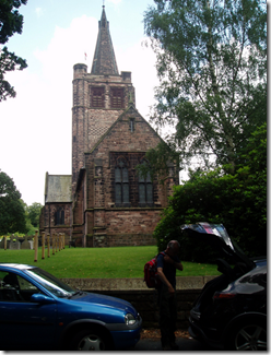
imageLeaving the car on a quiet lane we made our way through the village towards the Bridgewater Canal. Judging by the inscribed stones on some of the houses, the Greenhall family were once quite influential in the area. Their Wilderspool Brewery supplied most of the local pubs for many decades.

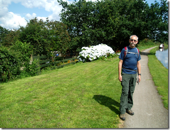
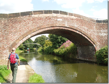
We were soon on a familiar section of canal towpath, part of the route on my recent bike-packing trip, albeit in the other direction. Walking East (East is good) along the towpath we came across runners, cyclists, dog-walkers, and of course canal boats – although not all were pleasure craft.imageWalking through Stockton Heath, under the A49, and on to Grappenhall by the canal, it was very easy to forget that we were very close to  ‘civilisation’, such was the tranquillity of our route.

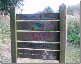
imageLeaving the canal to walk through Grappenhall Wood our route took us west-ish

image

Very pleasant woodland paths of the Mersey Valley Timberland Trail took us around the edge of a modern housing estate and continued through the wooded sandstone edges of The Dingle and Lumb Brook Valley. Although it was a pretty little valley, the brook was a bit whiffy – perhaps it was the hot weather and proximity to housing. Looking at the map, the brook may be called Dipping Brook. Perhaps it was something ‘they’ had dipped into it.

image

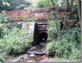
Dingle Lane Bridge over Dipping Brook

(which wasn’t at all whiffy at this point)

Then it was time to get lost. A walk wouldn’t be a proper walk if it all went to plan now, would it?

It was probably because we were gassing too much. Or the bright sun that was shining in our eyes. In our defence we only went a bit wrong and it didn’t take more than a minute or so to locate our position on the map. 

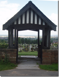
Back on track, we crossed the A49 Roman Road and climbed up to Hill Cliffe for our lunch stop. Munching our butties, we had a good view of Winter Hill, Warrington, and, er, the cemetery. The sun was burningly hot, too hot for me to keep my Tilley on – I think I need to get a lighter-weight one.

image

imageTrying (unsuccessfully) to be artistic

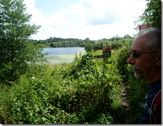
Appleton Reservoir, popular with anglers (WAA Members only, No Day Tickets. Have a nice day), birdwatchers, nettle-lovers and biting bugs, was our next target.

image

image  The heat got hotter, I got sweatier, Rick looked cool. It’s his glasses you know.

Then there was (were?) Creamfields. Being a boring old fart who doesn’t get out much, I hadn’t heard of Creamfields. At first I thought it might be a dairy farmers convention. Or a peculiar coloured landscape. But no, it’s some sort of music festival that costs lots of money to get in to…just so you can have your ear-drums blasted with megawatts of sound. I shan’t be going. It’s being held over the August Bank Holiday anyway. And I’ll be washing my hair that weekend.

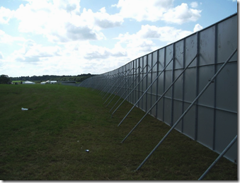
Emerging from Row’s Wood we spotted little coloured flags stuck into the ground. Then there were the enormous pallets of what we were to later learn were sections of barrier, designed to keep folks out of the Creamfields site. Or maybe to keep them in? The site area was huge. It’s a sell-out event, 55,000 tickets sold….which is the REAL reason for me not going. Perhaps.


image Keeping folk in…or out?

image Temporary mobile phone mast, needed if 55,000 fans all phone home at the same time

Leaving the festival site behind, we crossed the A56 to get back to the peace and quiet of the well-manicured canal towpath once again.

imageMarching Eastwards (East is good) once again, we soon came to Moore village which has a shop selling ice creams. Well it would be rude not to….wouldn’t it? And it WAS very hot. So we did.

Our ice creams were demolished quickly and it wasn’t long at all before more towpath tramping had us back at the car.

imageThe final stretch of towpath before getting back to the car 

imageThe End 

Well it’s not the end really. I’m still here and there will be more.

We had a good day. Next time, and there WILL be a next time, we’ll extend the route slightly. This will put a couple more miles on. The extra bit is plotted so it’s just a matter of doing it.

Thanks Rick! My turn to drive next time…..you can buy the ice creams,

Vital statistics:

21 of your foreign kilometers, 650 of yer English feet of upness.

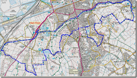
imageIf you look carefully you’ll see where we were, er, slightly off-route.

Monday 13 August 2012

Sunday 12th August, Milly’s Edale Round

OMer Stephen spends much of his time in the States these days, his current visit to Europe was celebrated by a weekend of Peak District walks arranged (she wouldn’t be happy if I said ‘organised’) by Milly, a fellow OMer.

OMer, for those not in the know, is the description for one who frequents Outdoors Magic, a website with excellent forums, dedicated to those who do outdoors stuff. Like me.

Saturday’s walk had been in in the White Peak, whilst today’s walk was in the Dark Peak. I couldn’t get to the Saturday walk so today’s would have to suffice.

Seven walkers met at the Edale’s P&D car park, ready for a 10am start.

imageAlthough there was high cloud it was a very warm morning and I was happy to let my knees come out to play. Milly marched us out of the car park in the direction of the Nags Head…perhaps we were going to get all sociable before we hit the hills? Ooh, goody!

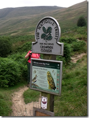
Disappointed, I was steered away from the pub in the direction of Grindsbrook Booth and Upper Booth. The Plan had been to go up to the southern edge of Kinder by using the tourist route by Jacob’s Ladder. At Upper Booth, local lad Jim pointed out an alternative way to the top avoiding the boring Jacob’s Ladder bit.  A lovely footpath climbed, gently at first, up Crowden Clough towards Crowden Tower. This was definitely a nicer route than Jacob’s Bloody Ladder. I’ll use it again.

imageMilly, being a shy and retiring sort, hiding from the paparazzi 

Crowden Brook had to be crossed a couple of times as we climbed, some found it more difficult than others:

imageThe sun was out now and it was bakingly hot as we climbed up towards Crowden Tower, fortunately we all had plenty of water. Once high up on the edges we stopped for our Official Lunch – as opposed to our Unofficial Lunch….which we didn’t seem to get round to. Curious.

image

Poor Maria seemed to be suffering from an embarrassing ‘problem’:

imageWe didn’t like to mention it, not in front of friends anyway. Don’t worry Maria, help is available these days. She’s such a nice girl. I’ll have a quiet word with her next time.

Our task-master pushed us on, through the weird shaped tors of the edges, in the direction of Edale Cross.

imageIt was a bit clearer up here compared to my last visit with Lynsey and Alan. And it was much warmer.

Rounding Swines Back I spotted the figure of one of the Peak Park Rangers ahead of us. He stopped to chat to us in the way Rangers do. There was something strangely familiar about this man but I couldn’t place him. Then it clicked: ‘Are you a Challenger?’ I asked. His face lit up – it was John Burt who I had met for the first time in the Monadhliath on my 2011 Challenge.

imageJohn Burt, veteran of 14 Challenges 

Maria had been thinking of applying for TGOC2013, John’s enthusiasm for the Challenge had all but convinced her to apply. Well done John!

John walked with us as far as the trig-point at Kinder Low, then he had to continue his Rangering duties as we turned East (East is good) to walk back towards Crowden Tower. It was lovely to see John, he’s one the Challenge’s gentlemen.

The good path along the southern edge of Kinder is very popular with those out for a short walk, today was no exception – there were crowds on the path. It was a bit concerning to see that nearly all of them were woefully equipped for even this easy walking. It was rare to see a waterproof – and as the rain had started to do what rain does best, it must have made for uncomfortable walking.

imageCrag rats on the edges

The Plan was to drop off the edge by Ringing Roger. By the time we arrived there it had stopped raining and our waterproofs were packed away for the rest of the walk.

image Stephen (the other one) calling his wife to explain why he was late

The steep drop from the high edges soon had us walking over soft, grassy ground – a welcome change from the hard gritstone of the edge:

imageFinal Approach

We arrived back at the car-park at around 4pm. All good things must come to an end and this had been a good day in great company. Just a pity I couldn’t have done the Saturday walks too.

Thanks to Milly for making it happen, to Stephen (the other one) for being the reason for it happening in the first place, and to everyone else for being such good company.

imageStephen and Stephen. No idea which is which though….

The day’s (approx) vitals: 12–ish miles with about 2300’ of up.

image

Jim plotted the route in a rather more accurate manner using a GPS thingy.

Oh, and there are more pictures of the day here.

Milly’s (rather better) photographs of both days of walking are here.

Sunday 12 August 2012

Sunday 5th August, Three Halls and a Castle

A 19 mile walk from Kendal

Those fine folks in the East Lancashire LDWA are always up to something. If you’re at a loose and and fancy a walk in good company you can rely on the East Lancs Lot to have something on the go.

Today’s walk, ably planned and led by Dave & Alma Walsh, looked to be a good ‘un. Dave & Alma’s walks have a good reputation, they’re well researched and reccied so I wasn’t surprised to find a good turn-out of 19 walkers plus two doggies…who also walked.

LDWA walks always set off on time, so at bang on 9am the party of walkers were led out of the Scout Scar (free!) car park for the day’s adventures.

imageIt was a warm morning and I was glad to be wearing shorts. Although there was a light mist the views were good, Morecambe Bay could be seen in the distance.

Our route took us along Scout Scar, that although not high, was quite dramatic in it’s appearance and the views it afforded.

imageScout Scar, with Morecambe Bay in the distance. Honest. 

Once off the scar we were led past Helsington Church, a building that dates back to 1726….so it’s quite old:

image

First stop of the day was at Sizergh Castle, home of the Strickland family for a year or two. Now a National Trust property, although the castle is still inhabited – presumably by the Stricklands. Rumour is that the lady of the house isn’t too happy with the way the N.T. run the show, so every evening she re-arranges the furniture when the National Trust staff go home – leaving them to put it back next day!


imageJust one of the Sizergh Castle buildings

After our brief elevenses stop we continued to the village of Levens and then through the grounds of Levens Hall to follow the River Kent.

image

imageThe River Kent flowing through Levens Park 

It was around here that a flock of Bagot Goats were spotted. These are now a rare breed and are regarded as an endangered species.

image Bagot Goats. Funny looking things.

Our leaders pushed us on, determined to squeeze as much interest out of this route as possible, they succeeded. Well they succeeded in knackering me anyway!

image

Tiny Hincaster Hall was next, blink and you miss it:

image 

Leading her followers under the West Coast mainline, Alma refused to let up…..

image

….leading us on footpaths crossing cultivated fields:

image image

…..to pass yet another hall, Sedgwick Hall, sadly now divided into private apartments:

image

Clouds had begun gathering and the sound of not too distant thunder had the group looking anxiously skywards, it was really too hot to be wearing waterproofs.

Back onto the banks of the River Kent we skirted Kendal to get back to Scout Scar.

image image

Bridge over the River Kent

image imageThe River Kent, close to Kendal

image 

Scary thunder clouds

image

Climbing back up onto Scout Scar

Our last port of call before descending to the car park was ‘The Mushroom’, a renovated shelter on top of Scout Scar. The air was quite clear so views were good, it was possible to pick out the more familiar hills of the Lake District.

imageThe Mushroom and the last sit down of the walk

We arrived back at the cars at just after 4pm, not bad going for a 19 mile walk in Cumbria…although admittedly it wasn’t a mountainous route! This was a Good Thing, my hill fitness is sadly lacking.

Thanks to Dave & Alma Walsh for putting this walk on, it was a grand day out!

More pictures of the day are here.

Oh, and it never did rain!

Tally-Ho! Whitworth Wander / Turkey Trot 2023

  Whitworth Wander – Turkey Trot, 27 th of a very wet December 2023 In memory of the late Brian Whitworth, a fine man, my friend, and a for...