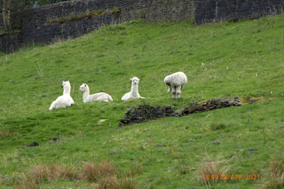
View from Oban Bothy

View from Oban Bothy

Friday, 30 April 2021

Hale – Knutsford Circular 30th April 2021

Kay, a regular with the After Eights walking group, was keen to do a slightly longer walk than the group usually do. She’d proved her mettle on a 10 mile Peak District walk some weeks earlier so I had no hesitation in suggesting this little bimble to her.

We left Hale at around 9am, it was bright and fresh (= cool), and joined the footpath heading east, that more or less followed the course of the R Bollin, under the M56, past the golf club, through Rossmill, and out almost as far as Castle Mill.


It was now getting rather warm – although we were moving at a fair old lick. Time to take a layer off.

Climbing out of the Bollin Valley, we followed a short stretch of tarmac to pick up more footpaths to eventually go under Manchester Airport’s Runway 2 via the rather magnificent River Bollin Culvert.


River Bollin Culvert, under Runway 2


For Helen H, aka 'Bat Lady'


One of the few planes seen that day

After a gawp at the tunnel, we wandered SW(ish) alongside the runway to eventually roll up around the back of Mobberley…where we we treated to hailstones and snow. Nice.

Waterproofs were quickly donned, and we were off – no time to linger. Well not for long anyway.

Crossing the Chester - Manchester line

A short stretch of tarmac took us, via a brief stop to say hello to friends Brian and Linda who live on this route, to a quiet and secluded entrance into Tatton Park. It’s one of those places that you’re unlikely to know where it is unless you know it’s there. If you know what I mean.

Kay posing by Tatton Mere


Prior to WW1 this area was cleared of trees to allow aircraft to take off and land. 

It was later used as a landing zone for No1 Parachute Training School in WW2


Tatton Deer

North through the park, initially following the eastern side of Tatton Mere, then to the No 1 Parachute Training School memorial….where we stopped for butties and a brew.

As I munched my butties, and Kay chomped on her ever-so healthy Rivita, we watched a plane come into land at Manchester Airport. Only the 5th or 6th plane we’d seen all day – testament to continuing Covid-19 travel restrictions.

Suitably fed and watered, we marched on, passing Tatton Hall and exiting the park by the Home Farm entrance (exit?) on the Tatton Mile. Which isn’t a mile at all.


Next came Rostherne, reached by following a Church Path, which is defined as  'A path, often crossing fields and designated as a customary right of way, leading or shortening the way to a parish church’.

There. Don’t tell me this blog isn’t educational. Even if the rest of the content is appalling. 


Kay and Rostherne's Village Pump


St Mary's Church, Rostherne

Another brief break, this time in the churchyard of Rostherne’s St Mary’s Church. The church is Grade 1 listed, and a church existed here as far back as 1188. So it’s a bit old.

Off again – Kay had ants in her pants and wanted to get moving.


Rostherne Mere

We followed the concessionary path around Rostherne Mere, which exists on the ground but doesn’t appear on the OS map. The path, not Rostherne Mere.

More tarmac followed, until we took to paths to take us back to the M56.

All was well until….


We weren’t going to let a little thing like a life-threateningly dangerous bridge put us off. Apart from anything else we were only a couple of miles from our cars, and we were damned if we were going to follow some airy-fairy footpath diversion….of which we saw no sign anyway.

We scrambled over the barrier, avoided falling into the river, and over the next barrier to safety.


A footbridge over the busy M56 (easy to see the effect of relaxing the Covid-19 lockdown) and more footpaths took us back into Hale and our cars.

‘Twas a good day out, I needed the exercise (I always need exercise), and Kay got her longer walk in: win – win!

Where we went:

Around 18 miles of Cheshire flat(ish)ness.


Thursday, 29 April 2021

Styal – Ringway 12 mile circular 26th April 2021

My Plan (Ho-ho!) was to be out of the door for around 7.30am to do a 6 – 7 mile brisk walk before breakfast, leaving the rest of the day for important jobs. Like decorating. And gardening.

I closed my front door behind me at 9.20am, so much for plans. It was quite chilly, too chilly for the shorts & T shirt I was wearing. There was still a frost on the part of my lawn that was shaded from the sun. The chill encouraged me to get my finger out and get a move on.

Leaving Heald Green I left the busy main road and joined quiet footpaths – very quiet when you consider how close it is to dense housing.

South towards Handforth, I passed through Outwood Farm, it brought to mind something that might have been dreamt up by Professor Quatermass.


At Styal I called in to have a quick chat with my friend Caroline at her very excellent Primrose Cottage Nursery – if you need plants and stuff like that you’ll do no better than here. Caroline really knows her stuff.


Onwards to Quarry Bank Mill, a National Trust property -  and very popular. As the lockdown restrictions are easing this place is getting busy. I managed to avoid the crowds and continued south to The Carrs on the outskirts of Wilmslow, before turning west to Morley Green – home of the Morley Green Club  - and, er, rather excellent ceilidhs:

Just sayin'


Quarry Bank Mill


Bluebells


River Bollin

For Conrad


For Alan R


North(ish) now, to follow the eastern edge of Manchester Airport. Not much activity – Covid-19 travel restrictions and all that.

Ripe for redevelopment?


River Bollin....again.

Cheshire fencing. I've not seen it outside of the county.


Rubbish dumped on the edge of Styal Village - reported


Back into Styal village ….and just a couple of miles of the dreaded tarmac to home. Oh well.


Where I went: 12 miles of flat pleasantness.

My route ended up a bit longer than originally planned: Home > Heald Green > Styal > Quarry Bank (NT) > The Carrs, Wilmslow > Morley Green > Manchester Airport > Home.

I’d have brought butties if I’d known. 

(Disappointing photos c/o my otherwise half-decent Oppo 72 phone) 

Outdoors Magic Mates Meetup 28th April 2021

Chewie (who is Simon) and Sarah were on a round the world trip of England and had invited Milly (who is Gill, and definitiely NOT a witch), Pete (who is Pete), and me, to meet up with them whilst they were staying on the Hayfield Camping & Caravan Club site.

The Plan (Ho-ho!) was to go for a short walk, eat cake, drink coffee, and have a damned good catch-up.

Rewind a few years: I met these lovely folk via Outdoors Magic, a one time extremely popular website for outdoorsy folk. The O.M. discussion forum was a lively place, populated by folk like us: outdoorsy types who enjoy a laugh and like to get out there and do stuff.

Sadly, O.M. has changed direction and has fallen from favour. The good news is that some of us manage to stay in touch and arrange the occasional meet-up….this was one of those occasions.

At 10.30am we met up at Hayfield’s quarry car park, conveniently located across the road from Simon (aka Chewie) & Sarah’s campsite. Pete had planned a pleasant, easy route…which just happened to incorporate a superbly lovely cafe that serves the best cakes in the whole wide world. Really. They’re delicious….and generally quite big.

I’m getting ahead of myself again.

For Judith


Mount Famine

We set off south(ish), towards Mount Famine (Anybody know how it got it’s name?). Rather than go as far as Mount Famine, we headed west to pass by Peep-o’-Day, Hills Farm, and then down to Ollerset and Birch Vale to pick up the Sett Valley Trail – a pleasant path that follows the trackbed of the former branch railway line from New Mills to Hayfield.

L>R: Milly, Chewie, Pete, Sarah


Peep o' Day:


Here is the very splendid Sett Valley Cafe – a lovely little cafe that makes the most delicious cakes. And pies and stuff like that.

Well, it would have been rude not to….

Chewie & Sarah indulging, note the defibillator...you can't be too careful


Our return route to Hayfield was along the flat Sett Valley Trail, no less lovely for it's lack of contours. 


We said our farewells and went our separate ways – but not before agreeing to meet up again sometime in the summer – hopefully more of the O.M. gang will be able to join us.

Thanks to Chewie & Sarah for coming up with the idea – it was a good ‘un!

Where we went:

6½ miles, with around 1000’ of ascent. And cake. 

More photos here


Lyme Park to Buxton, 18th July 2024

  A text message from my mate Vinny suggested we might go for a bit of a walk, he quite fancied Lyme Park to Buxton. It promised to be a ...