View from Oban Bothy

View from Oban Bothy

Friday 22 April 2022

Point-to-Point 2022, main route

Cheshire Hare & Hounds Tally-Ho!


Point-to-Point Hartley Folly 2022, main route: 14 miles / 2500’ ascent

New Mills Golf Club > New Mills Central > train to Edale > New Mills Golf Club

Route description:

MAP 1

Left (S), leaving New Mills Golf Club Car Park, downhill passing church on LHS, to New Mills and New Mills Central station.

Train to Edale, Departs New Mills Central: 9:17, 10:16, 11:16, 12:16, 13:16 etc.

Leave Edale station and turn Left to pass the Rambler Inn and the church, both on the LHS.

1) At the Old Nags Head, turn Left following the footpath signs: Pennine Way, Upper Booth, 1¼ miles

Pass through a gate (SK119859) to continue following the Pennine Way along a paved path.

Pass through another gate, the paving finishes, the path is now a well defined track, continue in the same direction, ie West.

At a clump of trees on the RHS, go through a gate continue ahead for about 50 yards where the path splits, take the path on the Left.

2) At some buildings (Upper Booth), follow the path, paasing through the buildings, to a T junction, Turn Right onto tarmac to cross a bridge over the River Noe – still following the Pennine Way.

3) Pass Lee Farm buildings on RHS, ignoring the ‘Residents only beyond this point’ sign,

4) Cross the packhorse bridge, take the R path indicating Jacobs Ladder….uphill.

Bear right and uphill, passing a cairn, keeping the valley bottom on RHS.

The path splits @ SK081862, leave the paved path, bearing L and uphill on a slightly stony path.

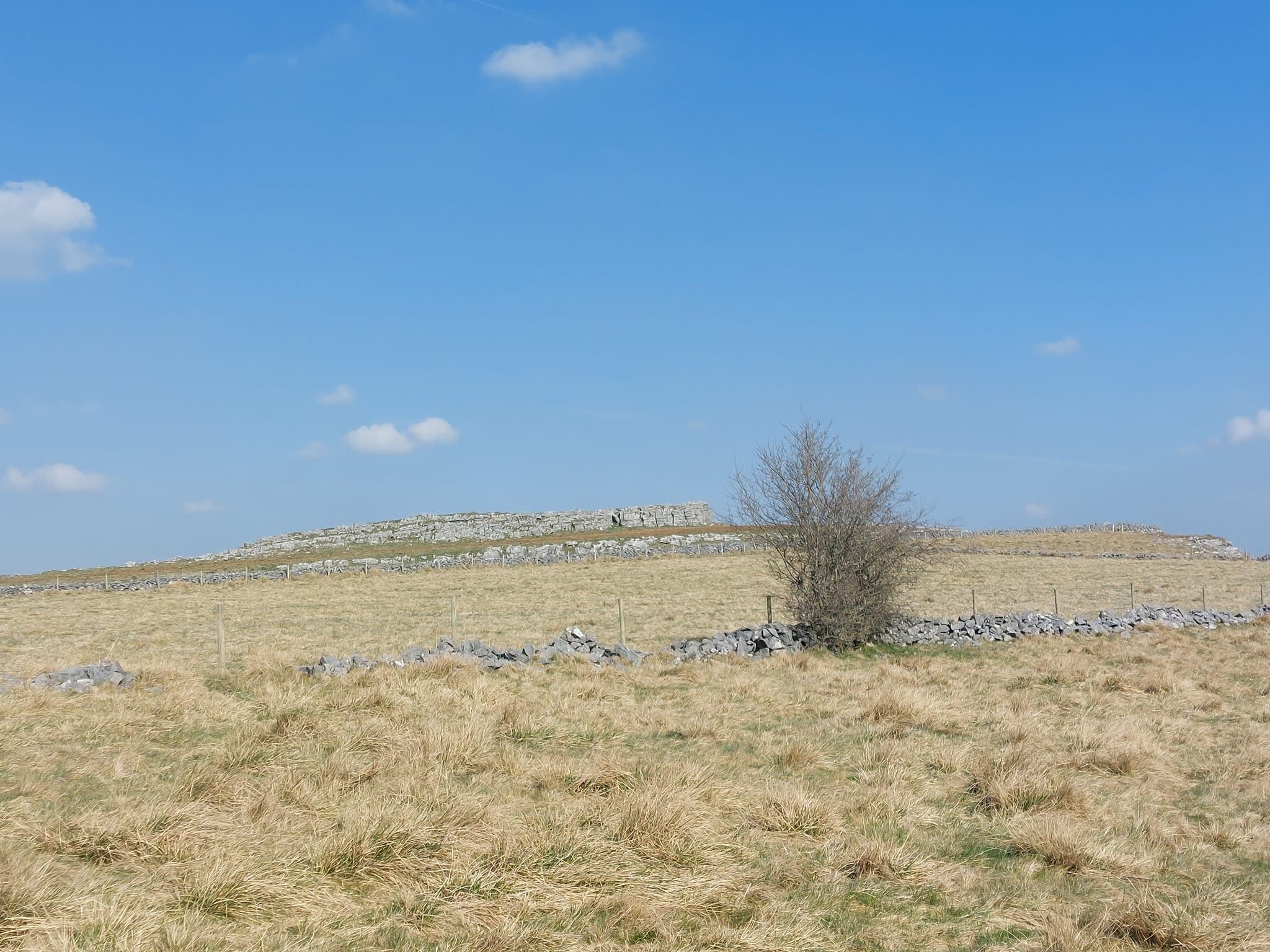
5) Do not turn up the Pennine Way, carry straight on along the well defined path., passing Edale Cross.

Cross a stream, stay on the well defined stony path, ignore path off to RHS to Hayfield via Tunstead Clough.

6) Downhill on stony path, through a gate, continue down the very stony track onto tarmac. Continue straight ahead, ignoring field track on RHS, and the tarmac road to the LHS.

MAP 2

Still descending, pass some buildings, to a split in the road, go Left along the bridleway which bears Left and starts to climb.

7) SP (Horseshoe) on LHS to follow bridlepath uphill. Mount Famine visible ahead.

Though a gate at the top of the hill, straight on, descending to go through another gate – continue straight on.

8) SK050854, go through a farm gate, turn Right then immediately Left. Note the sign ahead indicated left to South Head, 1 mile. Don’t go this way!

Go downhill, passing the small but still working quarry, then Left along the main Hayfield road.

9) Cross the road to Peep o’ Day…and, at 7 miles in, the Tea Stop for tea, cake, coffee, water, cake, crisps, and cake. And maybe a 5 minute sit-down.

Uphill to pass Peep o’ Day, then through a gate / cross a stile, then through a gate on the RHS to follow the path indicated by the PNFP Sign No5, to Birch Vale & Hayfield via Phoside.

Follow the path, faintly visible on the ground, under the power cables, to go through a gate. The path now has a drystone wall on the RHS, a fence on the LHS.

Go through another gate into open fields (hill on the LHS), continue, descending to follow a sunken path to go through a gate into Far Phoside, a house with a frog problem.

Continue downhill on a good track, at the point where the track bends to the Right, Turn Left over the stile in the wall.

Ahead and slightly downhill to the Right to cross a footbridge over a stream.

10) Continue ahead, slightly Right and uphill, following the direction arrows to go through a gate with a FP sign, continue uphill to another FP sign by a gate at the busy Hayfield to Chapel-en-le-Frith road.

Cross the road then follow a grassy footpath, uphill, to go through a garden (Public Right of Way), follow the footpath sign directing you to the right of a brick built shed.

Go through a gate on the LHS and go around the buildings, to exit at a lane at SK042864.

Cross over onto a track indicated as a Right of Way, continue ahead to climb slightly uphill to a farm track junction, Turn Left and uphill onto the concreted track – farm buildings visible ahead.

The track deteriorates to a stony track, pass the Public Bridleway sign, continue uphill to pass through a gate with an adjacent stile.

11) Take the track to the Left, ignoring the field track off to the right, keeping the fence to your Left, passing the redundant gate posts. At the end of the fence continue uphill to through a gate at the RHS of the trees visible ahead, noting the bench seat close to the gate.

Follow the path downhill, indicated by the rough bridleway sign, stay on the path as it bends L, then R, and becomes quite stony as it descends steeply.

Follow the path signed ‘PBW’ (Pennine Bridleway) round an acute bend Left, ignoring the gate at the crown of the bend, continue downhill.

Note the Hayfield Camping & Caravan Site on your RHS as descend further, down to the river.

Keeping the river on your RHS continue ahead into the centre of Hayfield.

12) Turn Right and downhill at a junction, and towards the church.

Turn Left at the church to cross the main road to follow the Sett Valley Trail, noting (maybe calling into) 13) the wonderful Sett Valley Café.

14) Cross the next road that crosses the Sett Valley Trail at an angle, note the proposed new housing development on the LHS.

A mile after the Sett valley Café, cross over Watford Bridge with industrial units on RHS.

15) Turn R up the far side of the first industrial unit (FLOWGUARD), keeping a blue fence on LHS.

At the end of the unit turn R down to the road, then turn L onto Watford Bridge Road @ S.F. Boxing & Fitness on LHS.

Cross bridge over the river, turn R.

Uphill slightly, turn L up Watford Road, which soon bends L.

Continue up the road, Turn first R @ FP sign ‘Watford Lane’.

16) Just before pylons, where the track widens slightly, opposite a large house (WILL HEY FARM) on RHS, Turn L, through a gate (not very easy to see, but it’s definitely there) and uphill, keeping closely to the drystone wall on your LHS.

Note the building over on your LHS that has a large solar panel array on the roof.

Turn L at the trees ahead, crossing the wall using a wall stile, continue, keeping the drystone wall on your RHS.

In about 15 yards, on RHS, at the end of the drystone wall, by a power pole, cross a stile, turn left, uphill on a track.

Continue uphill, cross a farm road, cross a stile immediately ahead, then uphill to go through a gate in the top RH corner of the field.

Follow the wall up to go through the farm gate, cross the road to a well-surfaced farm road that climbs up and soon deteriorates into a rougher, stony track. Note the hamlet of Whitle visible ahead.

At the point where the the track bends to the R, go through a gate on your LHS, to follow a fenced path for approx 100 metres to go through a gate, then ahead on the R, follow the path indicated ‘Bower House Farm, Walkers’.

Through the farm yard, through another gate, then follow the drystone walled path, indicated by a footpath sign.

Golfers may now be visible ahead….watch out for errant flying golf balls!

Enter the golf course by a stile next to a gate, continue ahead, keeping the wall to your RHS.

17) Follow the yellow topped posts, indicating the footpath, to New Mills Golf Club which is clearly visible ahead.


Point-to-Point 2022, short route

Cheshire Hare & Hounds Tally-Ho!


Point-to-Point Hartley Folly 2022, walkers / short route: 7 miles / 1200’ ascent: Saturday 23rd April 2022

Route description:

New Mills Golf Club > New Mills Central > train to Chinley > New Mills Golf Club

Left (S), leaving New Mills Golf Club Car Park, downhill passing church on LHS, to New Mills and New Mills Central station.

Train to Chinley, Departs New Mills Central: 9:17, 10:16, 11:16, 12:16, 13:16 etc.

Leave Chinley station by the footbridge, continue ahead to turn R @ ‘T’ junction: Lower Lane, noting ‘Chinley Bar & Lounge’ opposite.

1) At the top of a rise in the road, and when the ‘Buxworth’ sign comes into view ahead, turn R (SK036824) to cross the railway line by a footbridge indicated ‘Public Footpath, Local Nature Reserve’.

Follow the good path & steps uphill into a park by an Information / Noticeboard, continue uphill to exit the park by another Information Board at a road.

L on the road, follow the road uphill as it bends to the right.

Pass Dry Clough Farm on RHS, still climbing.

2) At the top of the hill, pass the entrance to Throstle Bank Farm on your RHS, continue a little further, and slightly downhill, to turn R up a signed Public Bridleway.

Pass through a farm gate, continue uphill.

3) Pass through another farm gate (SK030837), continue climbing, the gradient is now easier.

The wide track soon narrows, although it’s still a bridleway. Chinley Churn in on your RHS.

Pass through a single gate at SK032842, continue straight on, keeping the drystone wall on your LHS.

4) Continue ahead on the path, leaving the drystone wall on your LHS, path descends slightly to go through a single gate (SK034850), continue ahead, slightly to the left, ignoring the path off to the R (to Peep o’ Day).

Keep straight on, path descends further to a small wood (behind a drystone wall) on your RHS @ SK033859. Continue ahead and downhill, ignoring the track on your RHS, keeping the wood on your RHS.

Descend to go through a gate at SK030863, noting the aerial mast over to your Left.

5) Continue straight on and steeply downhill to cross the main road at Birch Vale, then to the Bus Stop and the road sign ‘Station Road’ to descend further down an almost hidden footpath to the Sett Valley Trail.

6) L onto the Sett Valley Trail, following the sign ‘New Mills 1½ miles’.

7) Cross a road, noting the very excellent Sett Valley Café (purveyors of tea, coffee, and highly delicious cakes) on your RHS.

Cross the road that crosses the Sett Valley Trail at an angle, note the proposed new housing development on the LHS.

A mile after the Sett Valley Café, cross over Watford Bridge with industrial units on RHS.

8) After the first industrial unit (FLOWGUARD), turn R along a footpath, blue fence on LHS, industrial unit on RHS.

At the end of the unit turn R down to the road, then turn L onto Watford Bridge Road @ S.F. Boxing & Fitness on LHS.

Cross bridge over the river, turn R.

Uphill slightly, turn L up Watford Road, which soon bends L.

Continue up the road, Turn first R @ FP sign ‘Watford Lane’.

9) Just before pylons, where the track widens slightly, opposite a large house (WILL HEY FARM) on RHS, turn L through a gate (not very easy to see, but it’s definitely there), and uphill, keeping closely to the drystone wall on your LHS.

Note the building over on your LHS that has a large solar panel array on the roof.

Turn L at the trees ahead, crossing a stone wall stile, continue, keeping the drystone wall on your RHS.

In about 15 yards, on RHS, at the end of the drystone wall, by a power pole, cross a stile, turn left, uphill on a track.

Continue uphill, cross a farm road, cross a stile immediately ahead, then uphill to go through a gate in the top RH corner of the field.

Follow the wall up to go through the farm gate, cross the road to a well-surfaced farm road that climbs up and soon deteriorates into a rougher, stony track. Note the hamlet of Whitle visible ahead.

At the point where the the track bends to the R, go through a gate on your LHS, to follow a fenced path for approx 100 metres to go through a gate, then ahead on the R, follow the path indicated ‘Bower House Farm, Walkers’.

Through the farm yard, through another gate, then follow the drystone walled path, indicated by a footpath sign.

Golfers may now be visible ahead….watch out for errant flying golf balls!

Enter the golf course by a stile next to a gate, continue ahead, keeping the wall to your RHS.

10) Follow the yellow topped posts, indicating the footpath, to New Mills Golf Club which is clearly visible ahead.


Saturday 26 March 2022

Tally-ho! Steeplechase 26th March 2022

I dislike races, I run for the fun of it – plus the physical and mental health benefits it affords.

Tally-Ho! is essentially non-competetive, although three races appear in the Club’s calendar: The Championship: an out and back trail race of about 10km, held on the last run of the year; The Steeplechase: an out and back trail race of about 10km, involving lots of stiles; and The Fell Race, another out and back race, involving a bloody great hill, and held at an unearthly hour at the Club’s Lakes Weekend.

The Steeplechase has been held at the Devonshire Arms in Peak Forest for many years – certainly all the time I’ve been a member, 22 years, and well before that.

The day was very warm and dry with a very strong sun – sunscreen was definitely needed.

I was given a ten minute handicap, my start time was 2pm, so, at 2pm I set off to follow the easy-to-follow, well laid trail – even in the very bright sunshine the sawdust trail was easy to spot.


The route had been changed slightly this year, some new fences had been erected and footpaths diverted, it still worked out at 6.2 miles / about 10km, with 750’ of ascent.

Most of the trail was laid over lush, green fields, although what was a muddy track but was now rock-hard-baked and quite dusty – and potentially ankle twisting. I don’t think the track claimed any victims though.


Dust was kicked up my the runners, my legs were quite grey with the stuff by the time I got to the finish.

Another runner flashed past me, it was Vinny – almost flying…and fortunately (for me) not racing, just out to run the route.


I got to the half-way mark, ahead of the rest of the pack, shook hands with the trail-layers, and began my run back. Fast Taylor almost immediately came into view – so I wasn’t doing THAT well!

Over the next few minutes I crossed paths with other, much faster, runners, all heading to the half-way point.

Almost inevitably, Fast Taylor overtook me, although it wasn’t until I was well on my way back. No other runners caught me – but their handicaps were almost certainly less generous than mine!

So that was it, I came second out of a huge field of, er, not very many at all.

The tin bath was pressed into service, but only cold water was available – at least I was able to wash off some of the dust.

Dinner at the Devonshire Arms was okay, just okay. Just. The beer, TT Landlord, was excellent!

Awards were presented, beer was quaffed in moderation, and we went on our respective ways home.


My award was sadly absent - again. Story of my life!


A good day out – we’re not out now until the Lakes Weekend, maybe giving me time to improve my level of fitness.

Pictures aren’t mine, they were taken by Wells, Vinny, Potter, and maybe others – I nicked most of them from the Club’s FB page.

More photos here.

Where we went:

10km, about 230m of ascent.

Wednesday 23 March 2022

Hope to New Mills recce

The Cheshire Tally-Ho! Hare & Hounds Club is a trail running club – rather an old one at that: we’re the second oldest running club in the country, being formed in 1872 –the oldest club being Thames Hare & Hounds. The Club’s well documented history makes for fascinating reading – a précis can be found here. 

Anyroadup, at the end of each season the Club hosts a longer than normal run, a Point-to-Point, aka The Hartley Folly, to which friends and family are invited to take part.

Covid successfully scuppered plans for the P2P in 2020 and 2021, but this year it’s going to happen.

The Plan was to run from Hope in Derbyshire, to New Mills in High Peak – a reconnoitre walk or two was in order:

Under blue skies and warm sunshine I met up with Vinny at New Mills station. This was shorts & T shirt weather – hard to believe we were still in March.

We hopped on the train to Hope, just in time to walk back to NM.


 Lose Hill, from the side of Win Hill

Leaving the station we headed north (and uphill), skirting Win Hill, then dropping down to the Hope Valley before climbing up to the heady heights of Lose Hill almost the highest point on the route. I didn’t quite need oxygen – it was a close run thing though.

We sat at the top for a few minutes, slurping coffee, whilst soaking in the beautiful view. 

Vinny, waiting for me. Again.


Mam Tor being buzzed by paragliders - loads of them


Turning west, we followed the ridge: Hollins Cross > Mam Tor > Lord’s Seat (this WAS the highest point on the route) > down to the road at the west end of Rushup Edge where we turned north along the Pennine Bridleway.

Rushup Edge attracted a huge number of paragliders - attracted by the great conditions.  

The point where the PBW leaves Rushup Edge was the intended tea stop.Tally-Ho! like a nice cup of tea. And cake if there’s any available….which there will be. Obv.


Towards South Head

We continued up by South Head and down to Peep o’ Day to the last climb of the day, up to the northern bit of the Chinley Churn ridge.

Respite followed: downhill to what was once the excellent Grouse Inn in Birch Vale (now sadly a private house), then west along the near as dammit flat Sett Valley Trail, passing by the lovely Sett Valley Cafe (excellent cakes!) back into New Mills.

Sett Valley Cafe


Back to where we started: New Mills Central

Conclusion: too far, and too hard. To clarify, the distance was fine, as was the terrain – it was just the combination of the two.

A rethink is being rethunk and Plan B is coming together.

Thanks ever so much to Vinny for coming along, being such good company, and helping judge the route.

Plan B will be along shortly.

Where we went:

18+ miles, with far more ascent than is good for a chap.

Interesting (disconcerting?) that the OS app measured this route as 15.5 miles. 

When I recorded it using my Garmin Etrex30 it came out at 18+ miles. Plotting the route on a couple of other navigation apps gave me a distance of 17.4 miles. 

More photos here.

Sunday 20 March 2022

Two Crosses 2022

My last Two Crosses, in fact my last LDWA challenge event, was in March 2020. Almost immediately after the walk, on 23rd March 2020, the whole country was locked down because of the damnable Covid-19. Everything stopped.

I couldn’t possibly NOT take part in the return event: Two Crosses 2022, and so I did.

Judith had once again foolishly agreed to join me. Unfortunately (luckily for her?) she tested positive for Covid-19 just a couple of days prior to the event so she had to withdraw….I was going to have to find my own way round without her expert guidance.

Unfortunately Martin & sue had also decided to withdraw for Covid-19 reasons - although just precautionary.

Kay, on the other hand, had expressed an interest in coming along. This would be her first ever challenge event, she was enthusiastic!

I rolled out of bed at stupid o’clock, washed some toast down with my morning Lavazza, and headed over to collect Kay for the drive over to the event centre between Tottington and Ramsbottom.

Getting ready for the off:


 Off to the start

After registering, and grabbing some tea and toast at the event centre, we wandered off to the start line for the 8am kick-off.

The weather was marvellous, dry, bright, and fresh – probably the best ever conditions I’ve encountered on this walk. I’d been out in area the previous day, running with Tally-Ho!, so I knew the ground was going to be uncharacteristically dry and relatively mud-free.

At 8am the throng set off, some running, some walking, some (like me) dawdling at the back.

Kay at the first of the two crosses, this one at Affetside:


 A pig. Obv.

It wasn’t long before the field spread out and, as so often has happened before, small groups were formed and new friends made.

CP1 at Turton Tower offered it’s usual warm and entertaining welcome, and when we left, stuffed with jelly babies, we had big grins on our faces.

Marching north, following the Witton Weavers Way, our next checkpoint was CP4 – the big feed! This is what East Lancs LDWA are famous for: great grub, and lots of it!

CP6, AKA the Big Feed:


By now Kay and I had fallen into conversation with a small group who were walking at our pace. They hadn’t done the Two Crosses before and were a little uncertain as to the route. I was appointed navigator. Fools….did they not realise my skills were only in acting – and I’m not very good at that!

Anyroadup, they had decided on a name for our group - although I'll be diplomatic and call us the 'A' Team! 

Suitably filled up with butties, pie, excellent cheese, fruit cake, malt loaf, bananas & custard, trifle, and jelly….oh, and jelly babies, we set off across the Turton & Entwistle Reservoir Dam -  for me this was the second time in 24 hours.

The Strawbury Duck came and went, and we marched purposefully on to CP5 at Orrel Cote Farm where we were able to top up our reserves of jelly babies and orange juce.

The weather remained glorious, the sun was strong, there was a refreshingly cool breeze…and it wasn’t raining!

Next to another highlight of the route, CP6, The Naughty Corner – temporarily re-named ‘Julie’s Knocking Shop’ – not by me I hasten to add!

For those not in the know, the Naughty Corner provides 'special' refreshment for those who want it: rum, whisky, sherry etc etc. 


                  For Judith...she likes this sort of thing


               Some of the 'A' Team were drinking. Tsk. ;-)

Suitably recharged and refreshed, we followed the edge of the Holcombe Moor firing range. No red flags flying today so we were safe.


The 'A' team at the second of the two crosses: Pilgrim's Cross on       Holcombe Moor - note that a few rosy cheeks have appeared since CP6. There may have been raucous singing too.


                                    T' tower


                                    Flahs


Next came Peel Tower, then the descent through Redisher Woods, the flatlands of Hawkshaw, across the golf course and finally the finish at Greenmount.

Well not quite the finish: we signed ourselves in and then had a slap-up feed of home-made soup, a selection of puddings – and gallons of tea.

Thanks to East Lancs LDWA for another superb Two Crosses – and special thanks for the wonderful food, and for arranging for such great weather!

Special thanks to the 'A' Team for being such good company and for foolishly putting their faith in my navigational abilities!

Where we went:

17.4 miles according to the route description, 17.6 miles with 2350’ of ascent according to Doris, my GPS. 

We weren’t racing, our moving time was just over 6hrs 38mins.

With stops at checkpoints our total time out was 7hrs 14mins.

More photos here.


Tally-Ho! Whitworth Wander / Turkey Trot 2023

  Whitworth Wander – Turkey Trot, 27 th of a very wet December 2023 In memory of the late Brian Whitworth, a fine man, my friend, and a for...