View from Oban Bothy

View from Oban Bothy
Showing posts with label Tally-Ho. Show all posts

Thursday 27 December 2018

Tally-Ho! Turkey Trot, 27th December 2018

The Club’s Hon Sec has been a bit under the weather of late so it was deemed that this year’s Turkey Trot be run close to his home so he could come out to see us, drink beer and join us for the post-run nosh.

The chosen venue was the Olde Number Three pub in Little Bollington, a pub that has had mixed fortunes of late but now seems to be well and truly back on it’s feet, serving good beer and good food at very sensible prices.

image

As a local lad, and having some knowledge of the countryside around the pub, I volunteered to plot, plan and lay trail. This entailed a 9am start….not the best plan for the day after Boxing Day….but there you go.

The route headed south following footpaths that crossed the odd stream and muddy patch. So far so good.

At the M56 the sawdust trail was laid East to pick up farm tracks, the tarmac of Reddy Lane and yet more tracks and tarmac…it’s a good job that the TT isn’t a candidate for Trail of the Season!

The trail led across fields and some seriously gloopy man-eating fetid swamps to the the familiar sight (for those who did the P2P a couple of years ago) of the Swan with Two Nicks.

P1060637

The pub was closed (Boo!) and the paths leading north into Dunham Park were quiet. The River Bollin weir was roaring well, testament to the recent rainfall:

P1060638

A couple of National Trust warden types were curious as to what I was up to, I explained and they seemed happy enough….actually they were mildly amused by the whole thing. It’s good to leave folk smiling!

Continuing NE through the now busy deer park (busy with visitors and deer) the trail eventually crossed Charcoal Road by the gated lodge entrance to enter the Dunham Golf Club which is conveniently criss-crossed by a number of footpaths. Laying trail here was a little difficult, I was trying to be inconspicuous….I don’t think my efforts were successful.

P1060639

We went the other way….


Emerging in Dunham Town the sawdust led northwards to pick up the Duke’s Cut and then into Dunham Woodhouses. Just short of The Vine (Sam Smith’s, £2 / pint) the trail went south….well it turned left anyway. The ground was a bit soggy and damp here, the route crossed a couple of streams (Agden Brook being one of them) and the River Bollin – by way of a footbridge.

At Agden Bridge Farm the route again joined the Bridgewater Canal towpath, this time heading east.

It may have been a little disconcerting to the hounds to be passing the Olde Number Three on the opposite bank of the canal and with no apparent means of crossing to it…..not without getting feet and other bits wet.

A solution to this little problem soon presented itself close to Little Bollington, a tunnel under the canal.

Splodging (uphill….please note!) through a field of horses the hounds were soon racing (?) westwards along the opposite side of the canal and the final run in to the pub.

Big Ian, camera in hand, was waiting at the pub……he’d not been out on the run but wanted to join us for lunch.

image

Only one hare today

Runners began appearing – Hon Prez Park being first man in, no doubt driven by thirst and hunger:

P1060643

Other runners appeared, running on t’other side of the canal but visible from the pub car park. Cameras were readied to record their auspicious arrival:

image

image

P1060641

P1060640

It should learn to calm down…


image

20181227_121744


image

20181227_115713

The Trail-Layer doing his post-run stretch

20181227_134558

Whalley had collected and transported the Hon Sec to the pub where we all enjoyed a beer (maybe more), a nice meal and, far more importantly, good chat with Brian – who seemed to be on good form.

It was a good run. I measured it at 8.8 miles with around 300 – 330ft of ascent, so not the hilliest of trails. Having said that, looking through the Club’s history it would appear that the route covered traditional Tally-Ho! terrain and so it was considered to be acceptable.

Turkey Trot 2018

Thanks to everyone who turned out to make it a successful day for the Club, and especially for Brian.


Photos by JJ and Big Ian
Wednesday 21 October 2015

Saturday 17th October, Tockholes – The Real Thing

Further to my little recce t’other day it was now time for The Real Thing, laying trail for the Club run.

Laying a trail on your own isn’t the easiest of tasks: there isn’t anyone else around to compare notes with, carry extra sawdust, whinge at, help with navigation etc. It’s down to the trail-layer, and if it all goes horribly wrong there’s nobody else to blame.

I left the car park of the very splendid Royal Arms at Ryal Fold, Tockholes at 11.15am. I was loaded down with a trail bag full of sawdust, a rucksack with more sawdust, a map and a bottle of water. The first part of the route was through woodland. I left great clumps of sawdust on the paths - an easy trail to follow. I thought. Nobody could POSSIBLY lose such a heavily laid trail. Of course they couldn’t.

Pendle Forest Orienteering Club were also out in the woodland, enjoying (enduring?) one of their Autumn Series events.
image

Orienteering kites were spread throughout the woodland

According to their website Tockholes was voted best area in Lancashire in the recent best 100 areas in the UK listing. I can believe it.

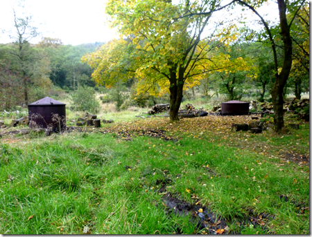
So busy had I been on my recce that I completely missed the charcoal burners deep inside the wood:

image

My route up to Great Hill more-or-less followed my recced route but somehow I managed to get my feet even muddier. 24 hours, a hot bath and two showers later my toe nails were still stained brown from the peat. Oh well.

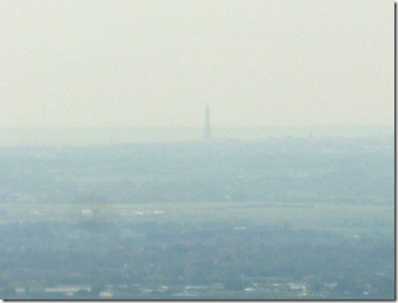
Visibility was marginally better than on the recce, it was possible to pick out Blackpool Tower on the horizon.

image That really is Blackpool Tower in the murk

There were more folk out today, it being a Saturday and all that. You don’t half get some funny looks when you’re charging around the countryside leaving piles of sawdust all over the show.

Leaving my recce route by Slipper Low car park I started the climb up to Darwen Moor. Really good tracks were dead easy to navigate, it was just a matter of keeping an eye on the map so as not to go (too far) wrong. On the climb I stopped a few times for a breather to look back towards Great Hill to see if there were any runners in view – not a one. I just hoped they’d not lost the trail.

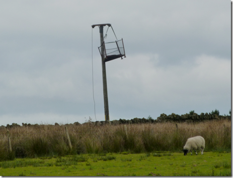
A most odd-looking contraption caught my eye as I flew <ahem> up the side of the hill. I had to stop (again) just to take the photograph. It took ages to compose.

image Any ideas folks? A look-out tower? An instrument of torture & torment?

Once high on the moor there were a goodly number of opportunities for rest – although I resisted temptation….of course.

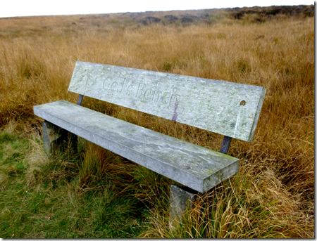
imageGed’s Bench – had me thinking of my mate Ged who’s a bit poorly

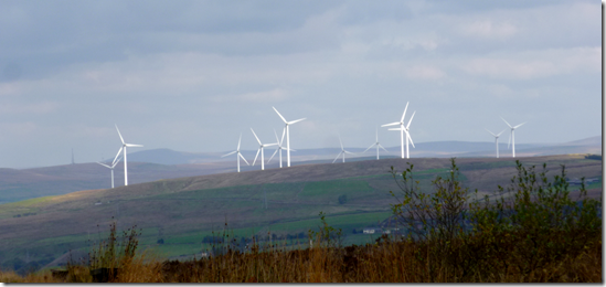
imageThe view east from Darwen Moor – looking towards Ramsbottom.

Peel Tower is just visible to the left of the windfarm. Windfarms like these are cropping up wherever there’s a need for an EU grant.

imageThen there was this great big bird y’see, just hovering there. I’ve no idea what it was, not being very good with birds, but I’m sure that the ornitho… twitchers out there will come to my rescue. 

Still no sign of any runners so I plodded on, now towards Darwen Tower – or more correctly Jubilee Tower. The tower was completed in 1898 and was built to commemorate Queen Victoria’s Diamond Jubilee. A few years ago, in high winds, the top blew off. Locals rescued the top and later replaced it with a fibre glass one instead. That one blew off in 2010 and has since been replaced with a new one made of stainless steel. It’s supposed to be getting windy tonight…I wonder?

image Jubilee Tower

A jolly bunch of ladies (a bunch of jolly ladies?) were finishing their jolly lunches at the tower. They recognised my Tally-Ho! kit, admitting to knowing some Club members. That’s a rarity in itself, hardly anyone I know would admit to knowing anyone in our club. :-)

image The jolly ladies with jolly Darwen in the background

5-600 metres of flat running on the NW edge of Darwen Hill offered great views over Lancashire and as far as Cumbria. Closer views were of the empty Sunnyhurst Hey and Earnsdale Reservoirs:

image

Still no sign of any runners. They’d either got completely lost, fallen into one of the fetid and man-consuming bogs that Lancashire is justifiably famous for…..or nobody had turned up. Oh well.

It was a steep descent from Darwen Hill back to the boozah which was now in view. Even so, the sawdust trail had to continue to the bitter end.

The orienteers were still out and about, their competition almost finished. I had a chat with a couple of the officials about the long lost 2 Day Capricorn event. Happy days, probably not to be repeated.  

Back at the pub for a very welcome and warming coffee. Although it wasn’t a particularly cold day I’d started to chill soon after I stopped running.

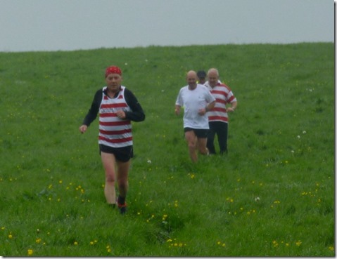
It was around 4pm when the first runner came in, Hon Prez Park – quickly followed by Hon Sec Shipley and Ding Dong. They seemed to have enjoyed themselves, not losing the trail much at all. Or perhaps they were just being polite.

The tin bath was put to good use. Being the trail-layer and therefore the first man back, I got the clean water. Perhaps I should try to run faster so I could finish earlier and get cleaner water on future runs……..nah!

By 5pm only half of the runners had returned, the fast pack were still out. They’d somehow got lost. That’s what happens when you run too fast. The early finishers were hungry so we sat down to a good dinner of Cumbrian Hotpot followed by Apple Pie & Custard – just what the doctor ordered. Halfway through our meal the fast pack rolled up, fortunately there was plenty of dinner left for them.

imageThe fast pack polishing off their dinner

Only 12 runners attended, a very poor turnout indeed – especially for this excellent venue, one of the very best.

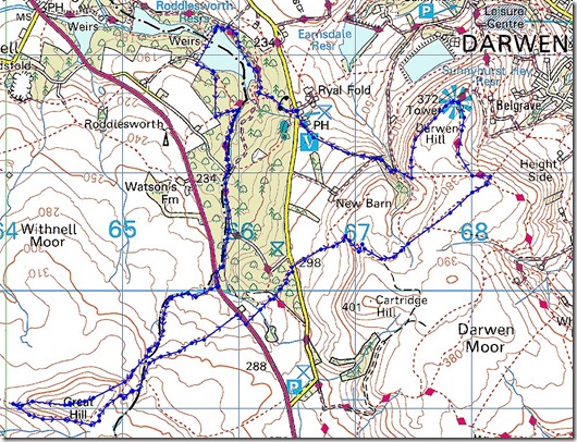
Where we went:

Tally-Ho! Tockholes 2015

9 miles with 1500’ of downhill.

That’s a lot of downhill, what’s to complain about?

The lost boys covered around 10.5 miles and  heavens knows, they must have done some serious uphill stuff.

Next time: Longnor in two weeks. I can’t wait!

What the prez said:

CHESHIRE TALLY-HO

The Royal Arms, Ryal Fold, Tockholes, 17th October 2015

Overcast ( later sunny ), 10 Deg, little wind.

The route started across the road from the pub down through Plantation No 2 and crossed the dam separating the Roddlesworth reservoirs. The trail turned south through Plantation No3 and crossed Belmont Road onto Wheelton Moor.

There was a large number of Pendle Forest OC scuttling from control to control. They were celebrating their 50th anniversary.

The first part of the moor was difficult with rushes, bog and Turk’s Heads but eventually high ground was reached and Great Hill came into view. Over the hill we headed for White Coppice familiar as the turning point of the Steeplechase.

We soon turned sharply back towards the bog and Belmont Road. The trail chicaned around Piccadilly into the woods passing Hollinshead Hall ( ruin) , across Tockholes Road and round the shoulder of Cartridge Hill. The last climb took us up Darwin Hill to the Jubilee Tower (372) before dropping down to RyaL Fold.

We came across an old squeeze box player surrounded by saw dust in the car park. We congratulated him on the excellent trail and queried the uncharted rush bog, he retorted that there was a dotted line on his map and carried on playing.

A disappointing 12 eventually sat down to hot pot and apple pie after five headless chickens arrived having been up to the tower several times and covering extra distance. We all cried into our beer.

Jocys did an excellent job laying a nine mile trail on his own.

Sunday 4 October 2015

3rd October 2015, Tally-Ho! from Sparrowpit

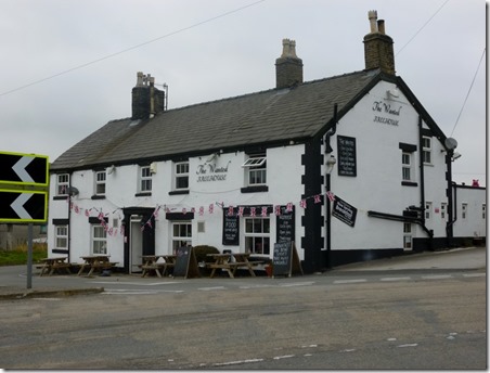
Those fine fellows of the Cheshire Hare & Hounds Tally-Ho! decreed that today’s run would be from the Wanted Inn, Sparrowpit.

The pub has had a chequered history in recent years, it’s been closed a few times – that’s hardly unusual these days. Some years ago it was called the Devonshire Arms, this must have been confusing as there’s a Devonshire Arms just down the road in Peak Forest. The pub’s owners put the place up for sale but there were no takers – it became known locally as the ‘Unwanted Inn’. When it eventually sold it was renamed the ‘Wanted Inn’. Obviously.

Anyroadup, between 1pm and 2.30pm groups of runners of a variety of abilities (and disabilities) set off running from the pub following a sawdust trail left by Mssrs Potter & Stanton, trail-layers to the nobility. Or something like that.

The weather was really good for running, dry and chillier than of late, although plenty warm enough to be running in shorts. It was a bit misty which didn’t do a lot for the views, but what we had was good.

I ran with Whitworth, neither of had done much running of late so we were well matched. As ever we chatted loads and consequently lost trail a few times. No problems with the general quality of the trail, it was well laid and generally easy to follow….although there were a couple of occasions when I thought the trail-layers were running low on sawdust – a couple of times the trail became decidedly thin.

P1050649Whitworth of the poorly knee, and equally poorly heel

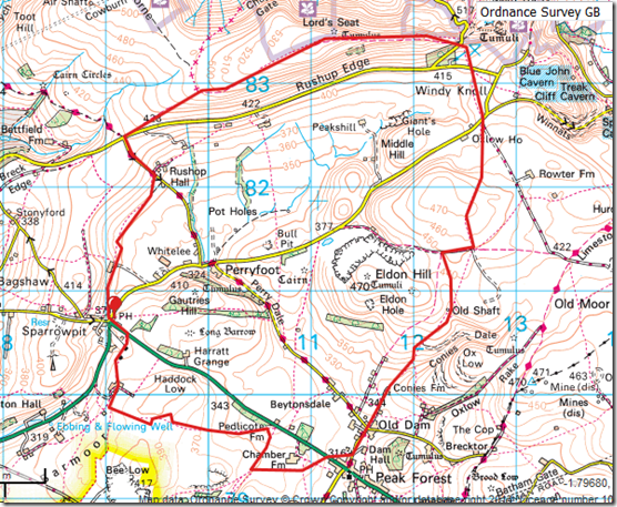
The anti-clockwise route headed south from the pub before turning east to Peak Forest, covering some of the ground used by the Club’s annual Steeplechase. The terrain was typically limestone: well drained and easy on the eye.

The word on the street is that quite a lot of the route will be used for next year’s Point-to-Point.

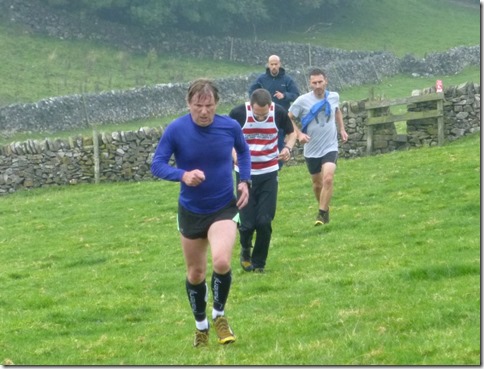
P1050651Wilson leading the Medium Pack   

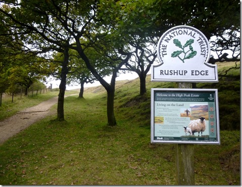
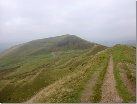
From Peak Forest the route turned north, passing to the east of Eldon Hill and then on to Windy Knoll where Rushup Edge came into view – in spite of the murk and mist.

P1050653McHarry leading the Fast Pack

P1050655

P1050658

P1050659

Because of the poor visibility the views into the Vale of Edale weren’t brilliant, although looking back towards the east was clearer:

P1050661

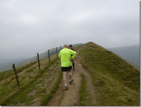
Eastwood had caught us up earlier and we trotted along together for a couple of miles until around Lord’s Seat on Rushup Edge when he pulled away.

P1050662Whitworth chasing Eastwood along the ridge

P1050664Rushup Edge is used as a launch site for people intent on hurling themselves into oblivion

P1050668The stony track along the top played merry-hell with Whitworth’s poorly heel.

    P1050669At the Pennine Bridleway the trail turned south for the last mile or so back to Sparrowpit.

P1050671  Part of The Pennine Bridleway

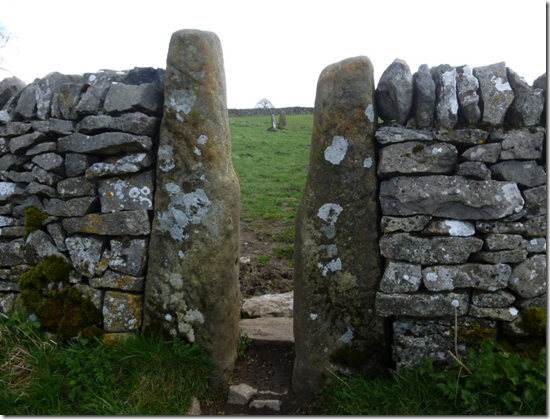
P1050673The route suffered from an excess of stiles, some were seriously broken, like this one just to the north of Sparrowpit, others were really on passable by those with very long legs. Like Whitworth.

P1050675The Wanted Inn, Sparrowpit 

Thanks to Potter and Stanton for laying such a good trail, they should be allowed out more often. Even more thanks to Brian for agreeing to run round with me, providing excellent conversation….and, er, buying me a pint at the end :-)

Shame about the food at the pub: a single course consisting of a small portion of stew with hardly any vegetables but bulked out with bread and not very good dumplings. It really wasn’t up to much – not when the club was charged £10 a head. If the Club runs from there next year I’ll duck out of the ‘meal’.

Bathing & changing facilities at the pub were pretty dreadful too: the tin bath was outside the back of the pub. I’m just glad it wasn’t cold & rainy. On the plus side the sight of 15 – 18 hairy-arsed runners stripping off probably gave the local ladies something to laugh at.

The beer was good though.

Where we went:

image

9.4 miles with around 1400’ of ascent.

Viewranger stuff here – although it shows the route as just short of 9 miles it’s actually 9.4 miles. I think it’s down to the way Viewranger uses waypoints to calculate distance.

More photographs here.

Tuesday 21 April 2015

Saturday 11th April, The Hartley Folly

A White Peak 15 miler

The Cheshire Hare & Hounds Tally-Ho! runs are always circular in nature, ie they start and finish at the same point. Except sometimes.

Tally Ho logo

One of these ‘sometimes’ is the Club’s end of season run, the Point-to-Point – also known as Hartley’s Folly, so named because someone called Hartley dreamt up the idea although the rest of the club thought it was barmy. That was a long time ago, and the Hartley Folly goes from strength to strength as the seasons go by.

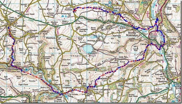
This year’s run was from Foolow to Tideswell, the long way. Fifteen miles of long way.

My day started with a train ride to Buxton and a bus ride to Foolow, getting me to the start at around 11.45am. I deliberately set off alone, I knew I’d meet up with other runners as the day progressed.

Some runners had started before me, the majority were to start around 12 o’clock – at least 15 minutes after me – in fact I spotted the largest group of runners lurking in Tideswell as I passed them on the bus. It was me on the bus, not them.

imageThe spring, almost summer-like temperatures of the previous few days had vanished. It was dry and bright, but cold and quite windy. Running in shorts wasn’t my best decision of the day…..it also wasn’t my worst.

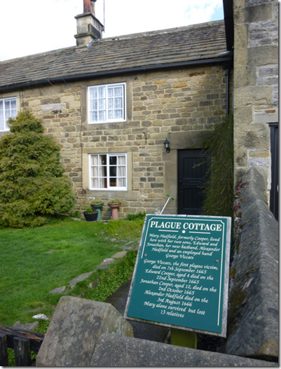
The route headed east out of Foolow, following easy footpaths to the plague village of Eyam.

image One of Eyam’s Plague Cottages

The sun was shining brightly but the cold wind was really biting, hat, gloves and a pertex shell helped keep the worst of the cold away.

P1040178

I won’t say I was feeling lonely. Okay, I WILL say I was feeling lonely – but at 5 miles I really thought the faster runners would have caught up with me. I kept looking back along the route but there was no sign of anyone. I was making good time with the easy downhill running through Stoney Middleton to the western banks of the River Derwent and on to Froggatt. At Froggatt the route doubled back, crossing the bridge over the River Derwent and running south along the eastern banks of the river by Curbar.

Still no other runners.

P1040181 Turning to head west meant a climb up to Calver. I was having such a lovely time in the dry and sunny conditions that I took a wrong turning, adding around half a mile and a stiff climb to my run. It was such a lovely day that I didn’t mind. Surely this extra distance and climb would be where the other runners would take the lead.

The first runners I came across, Brian & Marilyn, were early starters – they’d kicked off from Foolow at 10am. They weren’t exactly lost, but an error on the route description meant they were struggling to ascertain their exact location. Although I’d gone wrong earlier, I’d soon realised that I was off route and I knew where I was. Sort of.

P1040182

Brian & Marilyn

A couple of miles later we spotted a couple of fast runners coming up behind:

P1040184 Ding Dong and Hon Sec Ships

Ding Dong and Hon Sec Ships had both struggled with the same route description error but after half an hour of scratching heads and other bits they took a calculated risk and continued on what they correctly guessed was the right route.

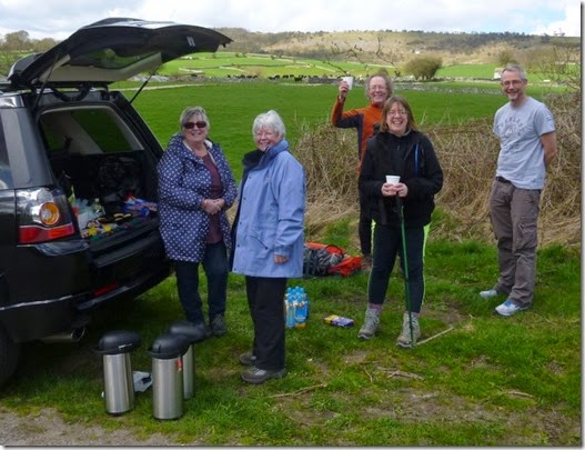
A mile or so later, on the outskirts of Little Longstone, came the very welcome tea stop:

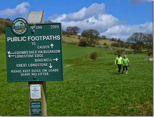
P1040185We were plied with tea & biscuits before continuing on our merry way through Little Longstone……

P1040191 Little Longstone Church

…..and then to Monsal Head. That’s where it all went horribly wrong.

The indicated route followed a more or less straight line from Monsal Head to Litton Mill. I was a bit puzzled that the track was so straight, particularly with it being over hilly ground. But this is the Cheshire Tally-Ho! and we do this sort of thing.

image

But not today. Although I did.

What I was SUPPOSED to do was to run through the railway tunnels that, er, follow a more or less straight line from Monsal Head to Litton Mill. Instead I set my compass and religiously followed what I thought was the correct track.

In my defence, m’lud, my map didn’t show the tunnels. Even more recent maps are misleading, they show what appears to be a Land Rover Track OVER this hilly bits. Normally such features are identified as ‘Tunnel’ on the map. Not this one.

P1040194I later found out that it was when I was battling up hill and down dale that the bulk of the runners had taken the lead, speeding along the flat ground through the tunnels.

P1040193

The rest of the route was pleasant, fairly flat and quite uneventful – I’d had enough excitement for one day.

The route continued to Litton Mill where the River Wye was crossed. Some tarmac running took me to the southern end of Tideswell Dale. It was then just a gentle 2 mile trot into the village of Tideswell and the very excellent Horse & Jockey, where a nice hot shower, a very refreshing couple of beers and a good meal fixed all that had gone wrong with my day.

P1040197This hadn’t been the most well attended of Tally-Ho! Point-to-Point runs of recent years, with around 40 people in all sitting down to dinner. In spite of the low numbers it was a huge amount of fun….even if I did screw up the route. The event was organised (wot?) and planned (eh?) by Fast Taylor and Doggy Burston – thanks must go to them for all the hard work they put in to making it happen.  

16.5 miles with 2300ft of ascent.

P2P 2015

Tally-Ho! Whitworth Wander / Turkey Trot 2023

  Whitworth Wander – Turkey Trot, 27 th of a very wet December 2023 In memory of the late Brian Whitworth, a fine man, my friend, and a for...