View from Oban Bothy

View from Oban Bothy

Tuesday 15 March 2016

Lands End to Timperley, Tewkesbury to Ironbridge

Tewkesbury promised a luxury night at a real campsite - hot showers, nice flat grass, drinking water that didn't need filtering...sheer heaven.

Well it would have been had the campsite been open, the campsite staff were adamant that I couldn't camp. This was serious, I was really quite knackered  - and cold. I'd been running on empty for the last few miles and I needed food inside me.

I must have looked as exhausted as I felt, eventually the campsite staff took pity on me and allowed me to camp. Facilities were limited but a loo, washroom (with oodles of hot water) were made available - and the grass was smooth. I'm extremely grateful to the staff, they'll never know - one condition of staying was that I needed to be away very early next morning, and I was.

First stop was Wetherspoon's for a decent breakfast with oodles of Lavazza filter coffee. Suitably refueled, and with a route in mind, I pedalled off towards the dark and dismal badlands of The North.

My plan was to keep to quiet lanes as much as possible but sections of major roads were quite unavoidable. Target destination for the day was Ironbridge YHA, although if I didn't get that far I had a couple of quiet campsites in mind - campsites that I knew were open ☺

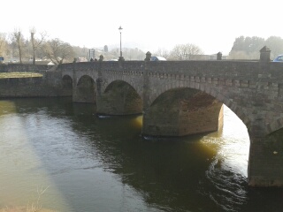
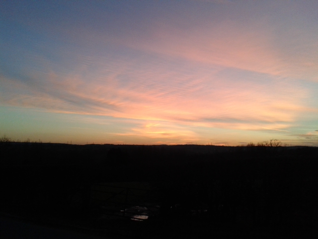
Highlights of the day's ride: the English countryside, the quite lanes, sunshine, exploring Worcester, Kidderminster and Bridgnorth, glorious views of the Malverns...and much more.

The not-so-good bits: the strong and cold breeze, some damned big hills (that always seemed to be UPHILL), bits of unpleasantly busy main road.

Sunday 13 March 2016

Lands End to Timperley, Abbey to Abbey.

And Wetherspoons to Wetherspoons.

A brilliant but hard day cycling through the Wye Valley (easy and dead lovely) and over & through the Forest of Dean (bloody hard but dead lovely). Today's been an Abbey to Abbey route: Tintern to Tewkesbury.  Now in my tent, fed and warm, but there's already ice on the tent @ 7.30pm.

Wednesday 9 March 2016

LEJOG, Oh the wind and rain

P1060215 - CopyP1060203 - Copy

P1060205 - Copy

P1060213 - CopyP1060218 - Copy

P1060223 - Copy

P1060222 - Copy

P1060221 - Copy


It was definitely a good move to stay at Penzance YHA last night. This morning the roads were littered with bits of tree and other detritus. Aktos are very good but last night's storms would certainly have tested it's mettle.

At 10am the winds were still far too strong to cycle, forget about cycling safely. So strong were the gusts that it was difficult to stand at times.

I went with Plan B: bus to Lands End and walk back to Penzance. To avoid camera shake from the wind (did I mention the strong wind?) I took photographs with my camera set to 'Sports Mode' ie: a fast shutter speed.

At Lands End the sea was quite spectacular, waves were crashing like nobody's business. A light aircraft flew over, it seemed to be almost travelling sideways - I'm rather pleased that I wasn't on board.

There were a few people tottering around Lands End itself but nobody was following the SWCP, opting instead for the safer inland footpaths and roads.

I was keen to visit the Telegraph Museum at Porthcurno, I quite fancied a play with their radio station - although I hadn't thought to bring my Amateur Radio Licence with me.....doh.

Unfortunately the museum was closed, shut, and not open either. That was the end of that then.

Never mind, a pint in the pub opposite would be reasonable consolation... well it would have been had it been open. Ho hum.

The beach at Porthcurno was quite beautiful, bathed in sunshine but whipped by an icy gale....there's that wind again.

The rest of the walk back was unremarkable, mainly because I was following minor roads. I've walked the coastal path before and that would have been a far more attractive proposition - had it not been for the wind.

I arrived back in Penzance around mid afternoon (I'd forgotten how lumpy Cornwall was) and still blowing an ice-cold hoolie.

Plan B rev1.0: head to Wetherspoon's, drink coffee and eat cake (twurly for a beer, even for me) and review my position.

The review resulted in Plan B rev1.1: stay another night in Penzance and head off early in the morning. I'm behind schedule but it matters not - as long as I'm home in good time to play a ceilidh on 19th March.

So that's it, 10 miles covered and around 40 miles behind schedule - but plenty of opportunity to catch up.

There are some rather poor photographs included - apart from a close-up of Longships Lighthouse, a mile or so off Lands End. That photograph came from Geograph, via Wikipedia.

Tuesday 8 March 2016

LEJOG, In the beginning....

At Navigation Road Station, Timperley

A long day involving a bit of cycling and lots of trains (4) saw my arrival in Penzance at 18.04 precisely.

This evening's Plan was to cycle to Lands End and stealth camp but the weather has worsened..... and it's going to get worsener still overnight, with 55-60mph winds and heavy rain forecast.

Quincyquontly I've booked into Penzance YHA for the night. The forecast isn't brilliant for tomorrow so Plan B is to go to Lands End by bus and walk back to the hostel, it's only around 10 miles so I should be back at the hostel by around 1pm. I'll jump back on the bike and pedal off into the East.

Being as wot the wind will be from the West, and that I'll be travelling East I should be able to get a good few miles in before tea-time.... I might be a bit soggy and damp though.

I was going to hit the local Wetherspoons but I'll try to support the YHA by drinking some of their beers. The YHA is a charity after all, and charities should be supported.

Tally-Ho! Whitworth Wander / Turkey Trot 2023

  Whitworth Wander – Turkey Trot, 27 th of a very wet December 2023 In memory of the late Brian Whitworth, a fine man, my friend, and a for...